Tag Archives: land surveying

What’s Inside Your GNSS Rover? Part 3
The third and final installment of a look at the inner workings of high-precision surveying rovers. In parts one and two, which appeared in the two previous issues, we focused on antennas, amplification, housing, channels, boards, and gates. This installment continues with signal matching, positioning engines, and additional components. Matching Signals To distill the observed...
Surveyor’s Corner: Next Generation
Putting the Future of Surveying In the Next Generation’s Hands For more than 20 years, the National Society of Professional Surveyors (NSPS) has organized a student competition in conjunction with its spring business meetings in Washington, D.C. Now organized by the Young Surveyors Network (YSN) of the NSPS, the competition hosts higher-education land surveying student...

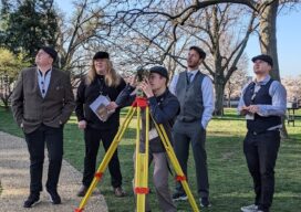
Spring has Sprung
Field Notes Is there a better profession than being a surveyor–especially in the spring? These are the beautiful days we all wait for with anticipation through the cold and windy days of winter. I’ve always felt that when one works outdoors, they freeze all winter for a few nice days in the spring and then...

xyHt Weekly News Recap: 05/12/2023
Phase One Takes Aerial Imagining to Another Level GeoBusiness is Back for 2023 USGIF GEOINT Symposium Set for St. Louis May 21-24 Vexcel Offers Access to High-Resolution Imagery in Australia and New Zealand Neusoft and HERE to Provide More Competitive Global Navigation Solutions Trimble Introduces RTX Positioning Solution for Package Delivery Applications via Drones WGIC...
xyHt Weekly News Recap: 05/19/2023
New Ways to Use Drones for Inspections and Quality Control AEM Hall of Fame Seeks to Break More New Ground HawkEye 360 Begins Manufacturing of Satellite Clusters Under Space Flight Laboratory’s Flex Production Program Drone Nerds Will Feature Thought Leaders for ElevateUAV Summit National Geodetic Survey’s Special NGS DAY at FIG Working Week 2023 NV5...

The Incredible UAV
Looking Forward Land surveyors aren’t just surveyors anymore. Map makers aren’t just cartographers anymore. We are all tied together in these geospatial professions of measuring, mapping, photogrammetry—anyone who collects and interprets data. We are ‘geospatialists.’ One of the things that tie all of us together is uncrewed aerial vehicles. A few years ago, who would...