Tag Archives: landsat
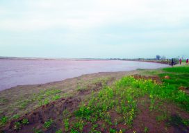
The Data of River Dynamics
Using GIS tools and readily accessible satellite data to study rapid change in rivers. Editor’s note: The dynamics of rivers can range from relatively stable to rapidly shifting, the latter especially in flood-prone regions exacerbated by a global increase in extreme weather events. The impacts are environmental, but also economic, social, and cadastral. Surveyors, for...
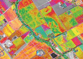
Satellite Imagery for Precision Agriculture
Precision agriculture consists primarily of using geospatial technologies to map spatial variations in crop and soil conditions and to match inputs—such as water, seed, and fertilizer—to those variations by applying them at variable rates. The link between the spatial variations and the variable rates are zone maps and prescription maps. The former show the difference...