Tag Archives: MAPPS

xyHt Weekly News Recap: 08/27/2021
Aero-Graphics Contracted by U.S. Geological Survey (USGS) SoCalGas to Use Gas Mapping LiDAR to Reduce Methane Emissions USDA to Use Planet Basemaps for 2021 Growing Season Assessment Maxar Awarded Big Data Analytics Contract from NGA Drone Operations Collaborative Helps Utilities Respond to Disasters Maxar Awarded $26M Contract for NGA’s Open Mapping Platform Hovermap Compatibility Expanded...

The State of MAPPS
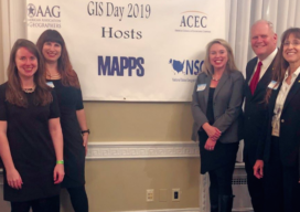
Rapidly moving forward in a pandemic and beyond It has been an exciting year in the MAPPS community! While much of the nation was somewhat idle, our MAPPS members were actively supporting our nation’s needs from our offices, at job sites, and remotely at our homes, fulfilling needs emanating from federal, state, and local government...
xyHt Weekly News Recap: 08/20/2021
Airbus’ UP42 Partners with HyperVerge for AI-based Satellite Imagery Analytics NV5 Geospatial Expands Mobile Mapping Fleet Webinar: Commercial UAV Expo Sneak Peek Future of Enterprise Drone Inspection Arrives with Plug-and-Play Integration NV5 Geospatial’s Michael Shillenn Elected to MAPPS Board of Directors SAM Announces Acquisition of Johnson Surveying and Mapping Esri and National Geographic Society Launch Global Storytelling Challenge Nearmap Aerial Imagery Expands...
xyHt Weekly News Recap: 02/19/2021
GNSS Receiver Keeps Around-the-World Yacht Race Winner in Position USGIF Accredits University of North Georgia New Trimble Total Stations Adds Versatility The Next Generation of Drone LiDAR MAPPS Awards Michael Baker International’s for Excellence NOAA Picks Woolpert to Collect Topo-Bathy Imagery NV5 Geospatial Unveils Cloud-based Data Management Platform
xyHt Weekly News Links: 04/17/20
MAPPS – COVID-19 Impact Webinar Series – REGISTER NOW! Hancock Associates Announces Promotion of Scott Jalbert, P.L.S. to Senior Vice President RIEGL Ultimate LiDAR Webinar Series How Will COVID-19 Impact the Present and Future of the Drone Industry? Esri Publishes The International Geodesign Collaboration Introducing OxTS Georeferencer – Helping You Create Accurate 3D Pointclouds Skytec...
The State of MAPPS in 2020
When I became president of MAPPS (a prominent national association of geospatial firms), I had two goals. First, I wanted to increase member engagement. Second, I didn’t want to work as hard as my predecessor. The two goals are not mutually exclusive. In fact, achieving the first goal makes reaching the second goal much easier....