MAPPS recognizes the best geospatial projects of the year
At its winter conference in Denver, MAPPS presented the annual Geospatial Excellence Awards to member firms whose entries exemplify the professionalism, value, integrity, and achievement of the firm’s staff as demonstrated over the previous year. The awards spotlight and honor the MAPPS members’ important and impactful work that addresses planning, design, and construction needs with geospatial solutions. A distinguished panel of judges evaluated the 16 submitted projects from five categories. Here are the winners.
Project of the Year Grand Award
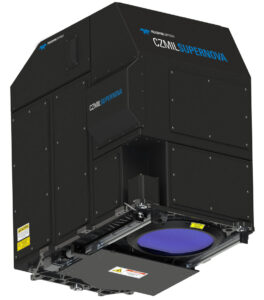
Teledyne Geospatial
(also winner of the Geospatial Excellence Award for Technology Innovation)
Teledyne Geospatial’s next generation Optech CZMIL SuperNova topo/bathy lidar system’s workflow is integrated with CARIS Base Editor software for seamless data processing capability and built-in AI techniques for land/water classification. SuperNova is designed for enhanced data collection capability, superior performance, and programmable, customized data collection options. The result is increased depth penetration, higher point density, and more complete coverage at a higher data accuracy specification. System design was driven by the need for one sensor that can meet a wide range of evolving bathymetric and topographic applications.
Geospatial Excellence Award for Data Acquisition and Processing
NV5 Geospatial/GEO1
(also winner of the Geospatial Excellence Membership Choice Award)
NV5 Geospatial and partner GEO1 collected lidar and image data of erupting Kilauea Volcano. The purpose of the acquisition was to create a follow-up baseline survey to model and predict future activity for the enhanced safety of residents.
The project brought attention to the value of remote sensing in natural disaster response and monitoring and has become the model for the use of geospatial technology to study active volcanos and improve public safety. The award also confirmed remote sensing data as a critical scientific resource for studying Kilauea’s present and future activity.
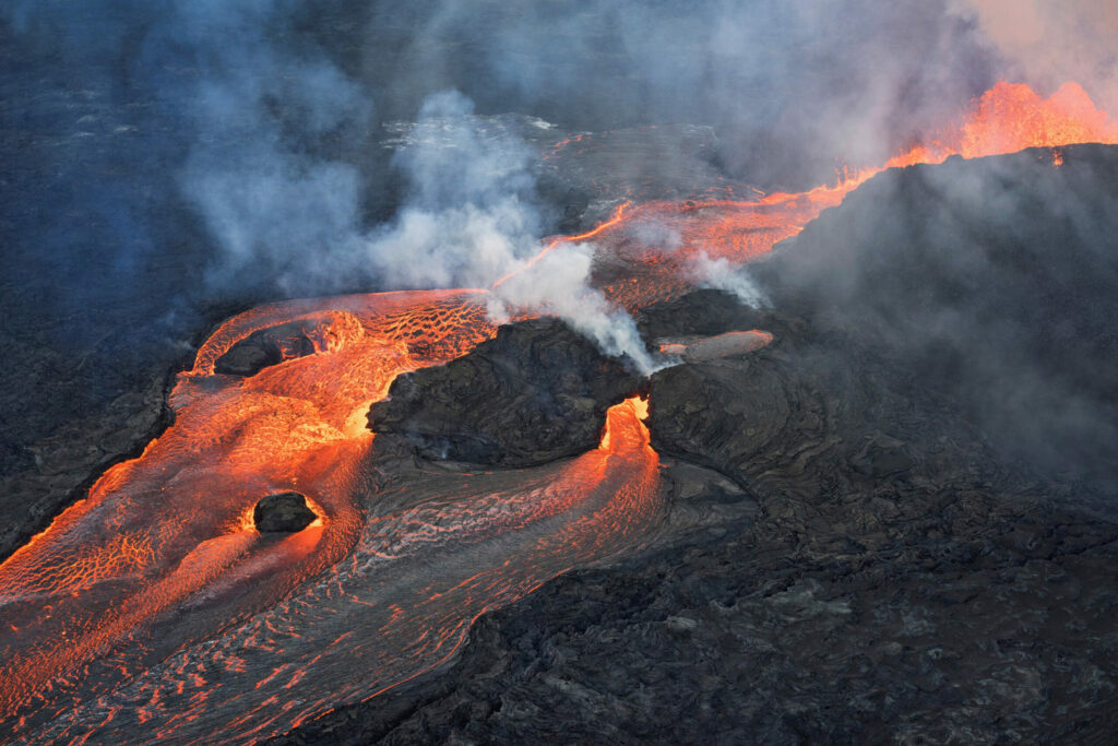
Lava flowing from Kilauea Volcano.
Geospatial Excellence Award for GIS/IT/Remote Sensing Analysis
Dewberry Engineers
Dewberry helped the National Oceanic Atmospheric Administration and the Bureau of Energy Management modernize their public provisioning system that publishes the U.S. Coast Guard’s National Automatic Identification System (AIS) vessel traffic data. Leveraging geospatial and cloud technologies, developing a flexible and scalable tiered architecture, and using innovative code deployment, this vanguard system is the template prototype to move NOAA’s resource portfolio to the cloud. Faster self-serve access to AIS data speeds up monitoring and decision support for maritime operators, environmental planners, and scientists.
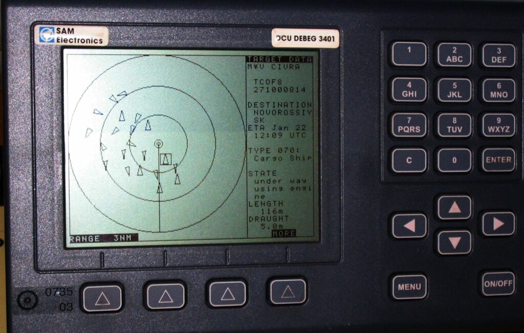
An AIS-equipped system on board a ship presents the bearing and distance of nearby vessels in a radar-like display format.
Geospatial Excellence Award for Surveying/Field Data Collection
Michael Baker International
MBI partnered with the Kentucky Transportation Cabinet (KYTC) to implement an innovative compliance inventory solution using mobile lidar to locate, measure, and evaluate critical pedestrian infrastructure throughout the Commonwealth. The goal was to foster increased quality of life and stimulate economic opportunity. Compilation of the statewide Americans with Disability Act (ADA) Transition Plan leveraged MBIs ADA Precision Toolset (ADAPT) to automate evaluation of 34,500 curb ramps, 18,600 crosswalks, 13,100 intersections, and 1,630 miles of sidewalk.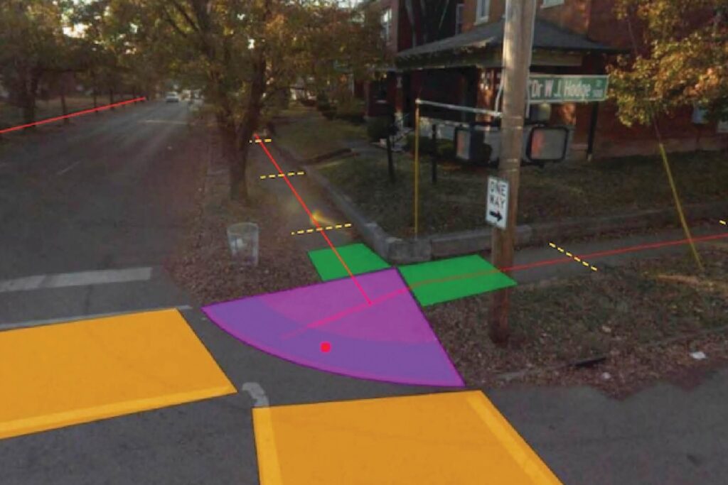
Geospatial Excellence Award for Small Projects
GEO1
GEO1 acquired data that will be used to produce a permanent, open-sourced, digital archive of Muir Woods National Monument, through The Earth Archive. A publicly accessible digital twin provides research opportunities for a wide range of scientists contributing to a fuller understanding of global earth system change. The high-resolution Muir Woods scan also demonstrates the feasibility of dense lidar acquisition and the value it presents for science and industry.
GEO1 collected the data for The Earth Archive, a non-profit group dedicated to digitally archiving the world’s most endangered areas for preservation and scientific study. The data will also be contributed to the USGS 3D Elevation Program (3DEP), as part of the organization’s effort to acquire and consolidate high-resolution lidar data of the entire nation.

Redwoods of the Muir Woods National Monument north of San Francisco.