Tag Archives: NSPS

Surveyors in Demand
Surveyor’s Corner: An exercise in public relations
Great Time to be a Surveyor
In collecting thoughts and observations for this article about the future of surveying, many of my colleagues and contemporaries offered words of condolences and sadness for the profession. It is often shared with me that we are a dying line of work because technology is allowing those without education or experience to do what we...
Personnel Moves
Questions and Answers How the NSPS is working to tap new sources to expand the surveying labor pool In an interview with xyHt’s Linda Duffy, NSPS president-elect Davey Edwards, shares information about ongoing NSPS initiatives intended to alleviate shortages of qualified workers in the survey profession. Edwards is survey director for Baseline|DCCM, What would...

xyHt Weekly News Recap: 10/27/2023
NSPS and AAGS Scholarships Application Is Now Available Geo Week Projects 200+ Top-Tier Exhibitors from Across the Globe Bees360 Enhances Drone Airspace Management with Aloft Leica Geosystems brings Leica BLK2GO PULSE to market for intuitive mobile laser scanning Trimble Opens Labs at OSU to Advance Next Generation of Agriculture and Construction Talent Hexagon’s Geosystems Division...
xyHt Weekly News Recap: 10/06/2023
Topcon expands construction layout portfolio with LN-50 Cadcorp launches new EPC Data Service New Davis-Bacon Act Rules Go Into Effect Oct. 23 Esri and NSPS | Surveyors and GIS Webinar Series German campaign aims to get youngsters excited about mapping and surveying Drones Receive EASA’s C6 Certificate for BVLOS Flights in the European Union ...

Surveyor’s Corner: Next Generation
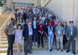
Putting the Future of Surveying In the Next Generation’s Hands For more than 20 years, the National Society of Professional Surveyors (NSPS) has organized a student competition in conjunction with its spring business meetings in Washington, D.C. Now organized by the Young Surveyors Network (YSN) of the NSPS, the competition hosts higher-education land surveying student...