All posts by Mary Jo Wagner
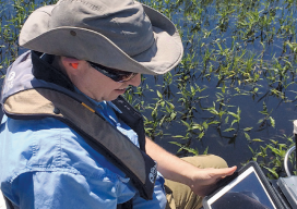
Fluid Data: GNSS and iPads
Lawrence Spencer puts the Trimble R1 GNSS receiver and iPad to work on the Kissimmee River. Pairing GNSS with iPads opens seamless data flows for a water management district in Florida facing wetlands complexity. Lawrence Spencer first joined the South Florida Water Management District’s (SFWMD) lake and river ecosystems section in 2006 as a...
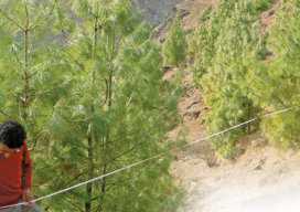
A Crowning Achievement in Nepal
An ICIMOD team manually validated the accuracy of the 2011 classification maps. Pairing satellite imagery with advanced object-based image analysis helps people in Nepal better manage vital resources. For decades, the high-mountain regions of Nepal have been caught in a perpetual catch-22. The small populations of these remote, isolated areas depend nearly exclusively on local...
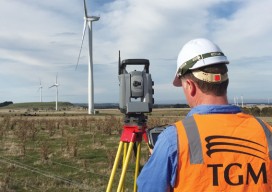
Capturing the Wind
A one-person crew provides foundational data for building a massive wind farm in Australia, using integrated survey technology. When you look at the commanding stature and aesthetically pleasing symmetry of the turbine towers at the Mt Mercer Wind Farm in southeast Australia, it is easy to gloss over the central role that surveying and engineering...
An Uphill Battle for Height
“You can’t change nature… But nature IS change!” – Remy in Ratatouille For decades climbers have struggled with the physical and technological hurdles of measuring the Earth’s highest mountain peaks. Now they’re turning to survey-grade GNSS equipment to measure extraordinary heights. It may surprise you to learn that the majority of the world’s mountains do...