Category Archives: Civil/Transportation
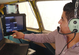
Using Lidar to Strengthen Ground Control
With the maturity of aerial photogrammetry in the early 1900s in pre-war Germany, military applications, especially reconnaissance and semi-accurate 3D maps and approximate contour lines, became the norm.
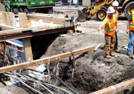
Preventing Damage to Underground Utility Lines
Common Ground Alliance (CGA), the national nonprofit trade association dedicated to protecting underground utility lines, people who dig near them and their communities, today published a Report to the Industry as part of its Next Practices Initiative. The Next Practices Initiative launched in 2020 with the goal of driving innovative solutions to the damage prevention industry’s biggest challenges,...
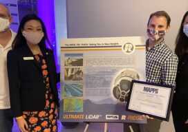
MAPPS 2020 Geospatial Excellence Awards
MAPPS honored members with the 2020 Geospatial Excellence Awards as part of the organization’s 14th annual Awards Presentation that took place January 26, 2021. The event was hosted by Riegl USA in conjunction with the 2021 winter meeting in Orlando, Florida. The Geospatial Excellence Awards are presented to regular and associate member firms whose entries...

Safe ‘n Sound: Distancing in Construction
IoT technology is helping workers maintain social distancing on the job site during the pandemic and making contact tracing easier. And it all starts with a beep. Months into the pandemic, construction workers in the U.S. already know the drill by heart: don a hard hat, wear a mask, wash your hands and keep distancing from...

Digital Coast Act Becomes Law This Week
The Digital Coast Act, now approved by both chambers of Congress, will become law this week, and that is a significant step toward expanding and making accessible geospatial data to support environmental and economic development activities in the coastal regions of the United States. The bill creates a program within the National Oceanic and Atmospheric...
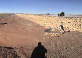
Surveyors Saving the Wild Pecos River from Itself
Survey helps protect land and wildlife from New Mexico river flooding “Well we can make it to the road in a homemade boat Because that’s the only thing we got left that’ll float It’s already over the wheat and the oats Two feet high and rising’” —Five Feet High and Rising by Johnny Cash If...