Tag Archives: BIM

Walden Environmental Engineering Captures New Insights and Revenue
Emesent Hovermap was used by Harkin Aerial to conduct internal and external scans of assets for Walden Environmental Engineering. This resulted in simplified and streamlined projects with improved efficiency.

The Center for the Arts in Nevada County, California Optimizes Operations
Mobile LiDAR scanner Hovermap was used to conduct an internal and external scan of the facility in just over an hour to capture accurate as-builts and CAD drawings.

Creative Uses of 3D Modeling
The 3D data collected with laser scanners and digital cameras can be used to create digital and physical 3D models that have myriad applications—from marketing a new building to routing first responders in an emergency.
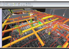
The Scan-to-BIM Process: Capture and Extraction
AECOM professionals adopt an integrated approach to best leverage the most current digital technology tools. With many aspects of the nation’s infrastructure reaching the end of its as-designed life, and with the purchasing power of construction dollars continuing to be stretched, developing systematic processes for determining the most cost-effective infrastructure investment strategy is critical. “Scan-to-BIM”...

Update: GeoBIM and 3D GeoInfo Conference
EuroSDR is a not-for-profit organization linking national mapping and cadastral agencies with research institutes and universities in Europe for the purpose of applied research in spatial data provision, management and delivery. Over the last few years they have ran several projects, one of particular interest being in the use of BIM (building information modeling) and geo-data in...

xyHt Weekly News Links: 10/09/2020
The Need for BIM Standards in Digital ConstructionDrones Will Help Reforestation After WildfiresSmarter GNSS Solutions for SurveyorsSugarbaker Joins Dewberry’s Geospatial and Technology GroupUSGIF Student Diversity AwardsSBG Systems supports Education with IMU, AHRS, INS/GNSS, and PPK SoftwareWoolpert Establishes UAS Hub in New Jersey