Emesent Hovermap provides great insights after new renovation, and valuable data for future renovations.
Sponsored Content
BACKGROUND
Nevada County, California possesses a rich history of firsts and technological innovations—from the Pelton wheel, which was initially designed to power gold mines and is still used to drive hydroelectric generators today, to the Nevada Theatre in Nevada City, the oldest theater built in California that once hosted Mark Twain and other famous historical figures. The Center for the Arts in Grass Valley is a state-of-the-art facility providing cultural and educational events and activities for the Nevada County community.
The center consists of a multi-use 21,000 square foot facility that includes a 492-seat Main Theater, visual arts galleries, classroom space, and a 90-seat black box theater. The center delivers upwards of 150 performances annually, serving diverse audiences in Nevada County and surrounding areas consisting of two-year-old toddlers to 90-year-old senior citizens.
THE CHALLENGE: IMPROVING OPERATIONAL AND LOGISTICAL EFFICIENCIES
In late 2019, the center completed a comprehensive renovation of its facility. Hosting countless artists and events annually, the center’s staff must reconfigure its space on a regular basis— sometimes several times per week. This can be a time-consuming and logistically challenging process involving seating, tables, theater props, decorations, and much more. The renovation includes some new additions—both outside and inside—that complicated matters further. The exterior includes portable stages that take up space and must be reconfigured to meet the requirements of the event or performer.
THE SOLUTION: SEND IN HOVERMAP
Fortunately for the center, the solution to its challenges was only a few doors down the street at the headquarters of EROCK LLC, which specializes in infrastructure inspection and consulting services. EROCK’s ability to address these challenges was made possible due to its investment in Emesent Hovermap LiDAR mapping system in early 2020.
“Center management, artists, and performers are better able to plan logistics and evaluate space usage, remotely, and to advertise the space more effectively.”
Eric Bennett, President and Founder, EROCK Associates, LLC
“There were a number of reasons we purchased the Hovermap solution,” says Eric Bennett, the President and Founder of EROCK Associates, LLC.
“For exterior projects, we spent a huge amount of time ‘fighting’ shadows. We literally would have a crew of four or five on a site for an entire day waiting for the sun to shift in the horizon so that we could capture photogrammetry of certain areas of a location.”
And with many of its projects limited by obstructions and corners, Hovermap LiDAR was an ideal choice for EROCK. “The space in many mines and buildings can be quite tight and void of GPS services,” Bennett notes. “Hovermap’s collision avoidance technology gives us a safety mechanism—enabling us to detect and avoid obstacles that could damage the drone and Hovermap. Colorization is also something that we’re excited about. We can provide point cloud scans that deliver additional context for visualization and analysis.”
EROCK is so excited about the Hovermap technology that the company is now the West Coast USA Service Provider of Emesent Hovermap.
DELIVERABLES: EROCK “ROCKS” INSIDE AND OUT
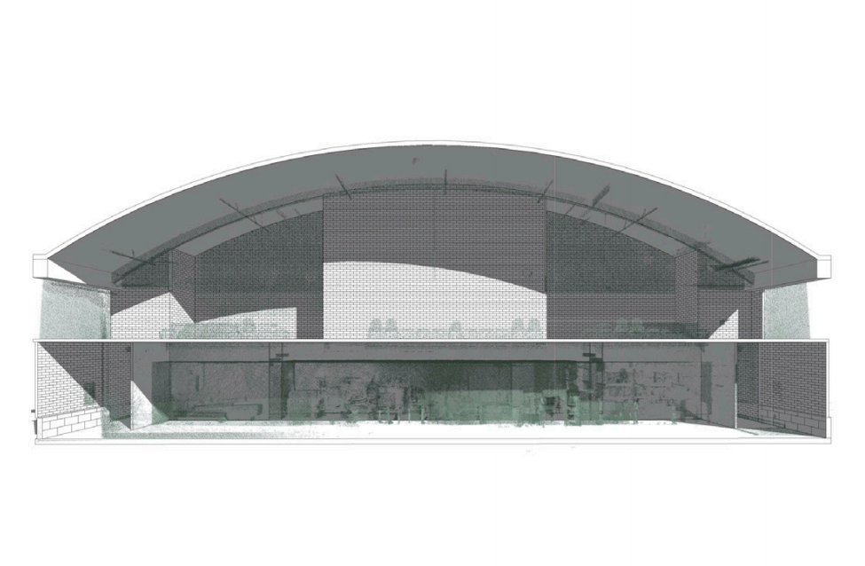
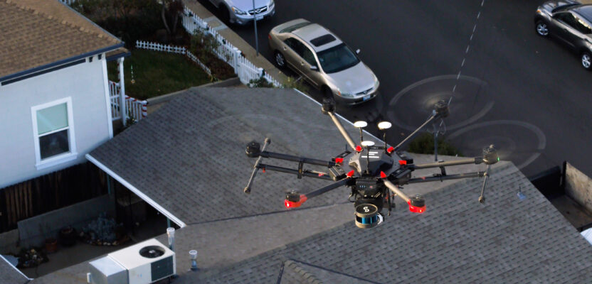
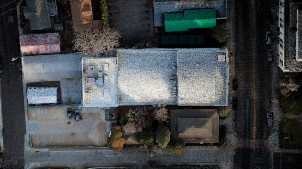
For the project at the Center for the Arts, EROCK used a drone with Hovermap attached to capture the exterior of the facility and walked to capture interior images. “Its versatility is one of the features that we like about Hovermap,” Bennett says. “It can be easily and quickly detached from a drone and walked through areas the drone can’t reach, or even attached to a pole and extended into areas in buildings that cannot be accessed otherwise.”
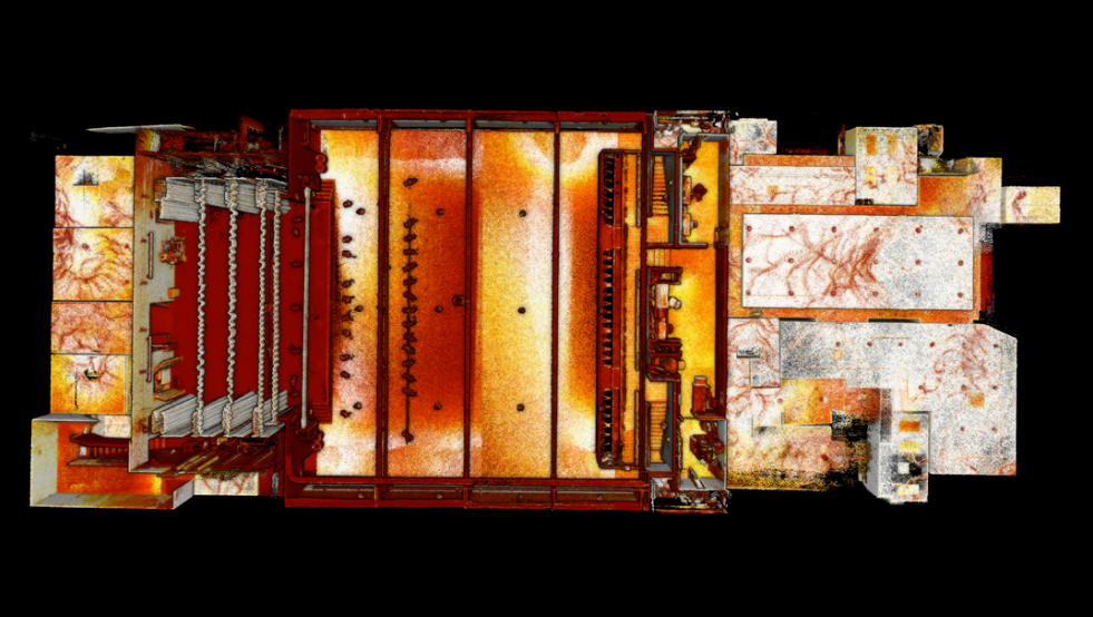
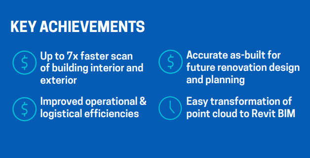
The exterior capture was colorized LiDAR. “We literally captured it all in one flight—in less than 15 minutes,” Bennett recounts. “The interior capture took a little more than an hour to do.” The difference between Hovermap and traditional terrestrial tripod laser scanning systems is dramatic. “It would simply have been impossible to capture the exterior shots,” he relates. “For the interior, it would have required a full day of work to do what we accomplished in an hour.”
Once the data was captured, it took less than two hours for EROCK to process the data into a point cloud and then export it in a PDF format for the center. Indeed, with terrestrial LiDAR data sets being much larger, the data transfer would have taken significantly longer. “Another example of where we have greater speed and agility to deliver data to clients quickly and accurately,” Bennett relates.
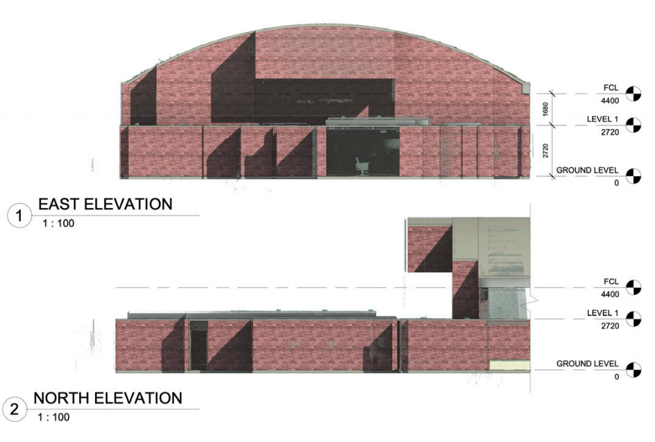
EROCK is brainstorming with the center on additional use cases as well. “ We’ve talked to them about integrating the data into their CAD system to compare the final structure with architectural plans,” Bennett says.
“Further, when it comes time for another renovation or addition, then that data can be useful.”
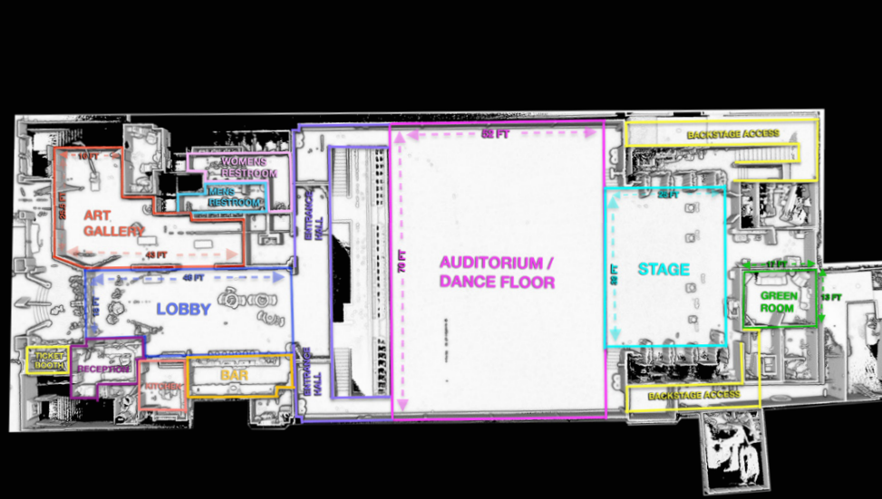
“The phase one renovation, just completed, was the first in a series of four planned renovations here at Grass Valley Center for the Arts. This entailed an extensive design and renovation of the ground floor facilities, including the auditorium, offices, art galleries, bar, etc. We anticipate importing information gained from Hovermap scans into design software for use in these planned renovation design and construction.”
David Spellman, Director of Facilities and Operations, Grass Valley Center for the Arts
BENEFITS: IMPROVED LOGISTICS, GUESSWORK NO MORE
Once the center is able to reopen its facility when restrictions surrounding the COVID-19 pandemic are eased, the staff expects positive operational outcomes. “The layout of the building isn’t going to change,” Bennett observes. “But the interior—and exterior—has a lot of moving parts and equipment that must be placed in certain places for different events. Their logistics are going to improve as a result of the visuals from Hovermap.”
“We will see more immediate benefit from the work EROCK did, and the results of the Hovermap scans; we now have the ability to share floorplan, dimensions, etc. to help our clients plan their events remotely.”
David Spellman, Director of Facilities and Operations, Grass
Valley Center for the Arts
“When the center has multiple artists perform on the same night, these operational efficiency gains will pay significant dividends—not simply in terms of the amount of time spent but the time between performances,” Bennett sums up.
“When the center has multiple artists perform on the same night, these operational efficiency gains will pay significant dividends—not simply in terms of the amount of time spent but the time between performances.”
Eric Bennett, President and Founder, EROCK Associates, LLC