Tag Archives: GIS
Using Ortho Imagery (Digital Aerial) in ArcGIS Pro
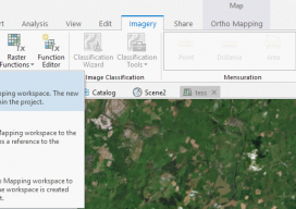
The new version of Esri’s ArcGIS Pro software offers the capability to use stereo imagery, something of great use to those looking to digitize and use 3D vector data. To this end, I thought I would try bringing in some stereo aerial data to see how the process works within ArcGIS Pro. Vague Knowledge At...
New EOS Platform Lets You Run Image Processing Tasks Online
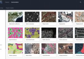
Sponsored Content by EOS Data Analytics Most of your image analysis tasks that required ENVI or Erdas Imagine software are now available online thanks to EOS Platform. This new game-changing cloud service launched by EOS Data Analytics provides GIS professionals with a one-stop solution for search, analysis, storing, and visualization of large amounts of...
Laser Scanning for GIS and FM
On the surface, rich laser- scan data seems like a natural, valuable addition to GIS and facility management (FM) solutions—and to related operations and maintenance and asset-management capabilities. Much as the emergence of GPS in the 1990s helped drive GIS adoption and growth, the emergence of laser scanning also feels ready to aid GIS, FM,...
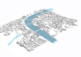
Esri CityEngine: What Is It?
These past few weeks I’ve been trying to do some clever augmented reality stuff with Unity involving putting an object on the floor and ensuring it doesn’t wobble when you walk around it. (Yay for SLAM in mobile devices.) Although in software like Unreal and Unity you can download or buy models, what do you...

Cool School
Siberian State University of Geosystems and Technologies Editor’s note: The name, “Siberia” evokes visions of a vast, cold, and perhaps foreboding place. Vast, yes, but also beautiful, steeped with fascinating history and resources and home to a diverse population imbued with a pioneering spirit. To meet the demands for qualified surveyors for the region, a...
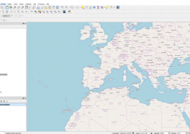
Using OpenStreetMap Basemaps with QGIS 3.0
QGIS 3 is a new wave of open source GIS. Not only is it extremely quick and efficient, allowing you to use almost every type of geospatial data you can throw at it, but it also includes a 3D renderer and ways to export your creations straight to the web. And let’s not forget the...