Tag Archives: nasa

Wanmei Liang
24 Young Geospatial Professionals to Watch in 2024 Company: NASACurrent position: Science Data VisualizerAge: 26 Education: BS in geography and minor in geographic information systems & technology, University of California, Los Angeles Liang works at NASA Earth Observatory as a science data visualizer, skillfully blending elements of cartography, journalism, and science communication by transforming data...
Space Mapping
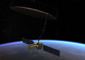
A satellite set to launch in 2024 will scan the Earth’s surface every 12 days. What does that mean for geospatial professionals? During the recent South Florida GIS Summit, I had the pleasure of attending a presentation by the National Aeronautics and Space Administration (NASA) that blew my mind in terms of potential for the...

xyHt Weekly News Recap: 01/14/2022
GEOINT 2022 Innovative Tradecraft Competition Entries Open Jan. 12 MdGroup Acquires GeoCue Group Riverside Mfg. to Assemble Commercial GPS Receivers in the U.S Golden Software Facilitates Map Making and Data Export in Surfer Package Esri Book Demonstrates How Maps Enable Cross-Sector Civic Collaboration Hexagon and Dayou Partner to Bring High Accuracy GNSS Corrections to China...
xyHt Weekly News Recap: 09/24/2021
NSPS 21st Annual Student Competition Geo Week 2022 Conference Preview INTERGEO 2021: Relaunch exceeds expectations Teledyne Geospatial Brings CARIS and Optech Together Vexcel Imaging Launches Aerial Camera Solution for Wide-Area Data Collection ConstellR and ScanWorld Partner for High-Value Agriculture Data Data Science Helps Raleigh Avoid Digging Up the Streets Woolpert Develops Guidebook on Airport Response...
xyHt Weekly News Links: 10/16/2020
How UAVs Make a Difference in Modern ForestryNew Topcon Robotic Total StationEarth Define Maps U.S. TreesNASA to Study Trees Impact on Remote SensingHxGN Content Program delivers airborne DSM to the Federal Agency for Cartography and Geodesy (BKG)Ronda Schrenk to Serve as USGIF Foundation CEO
Weekly xyHt News Links: 3/30/2018
EdgeTech Introduces the 6205s Next Generation Swath Bathymetry & Side Scan Sonar System senseFly takes drone flight planning & management to next level with release of eMotion 3.5 CANSEL TO DISTRIBUTE MICRODRONES FULLY INTEGRATED DRONE SYSTEMS THROUGHOUT CANADA NASA completes third phase of UAS airspace testing Intergeo 2018 to focus on geoinformation, digitalization SBG Systems...