Tag Archives: uav

xyHt Weekly News Recap: 05/26/2023
Overture Maps Foundation Names Marc Prioleau Executive Director Phase One Announces iXM-SP150 at GEOINT Trimble Advances Reality Capture with the New X9 3D Laser Scanner Maptitude Revolutionizes School Redistricting Process for Nashua School District Esri Opens New St. Louis Office in Emerging GEOINT District USGIF Announces 2023 Lifetime Achievement Award Recipient Sonardyne upgrade for India’s...
The Advantages of “Built Here”
There are reasons other than policy and security to consider domestically produced drones. Yes, when it comes to the drone market there is an almost “default” choice. Having established dominance, it further benefits from price by volume. And then they can invest more in R&D from the increased profits—if they choose to and do not...

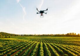
The Incredible UAV
Looking Forward Land surveyors aren’t just surveyors anymore. Map makers aren’t just cartographers anymore. We are all tied together in these geospatial professions of measuring, mapping, photogrammetry—anyone who collects and interprets data. We are ‘geospatialists.’ One of the things that tie all of us together is uncrewed aerial vehicles. A few years ago, who would...
Teaching the Ethics of Geo
Maps have always been powerful means of communication, whether etched in cave walls, stone, wood, silver of centuries past, or, in the 20th Century, copper plates and, later, film. In our own century, maps are everywhere—on our phones, computers, fitness apps, and news media, communicating in a myriad of ways about changes over space and...

From Nadir to Oblique
Spic-and-Span Bridges Inspecting the world’s iconic bridges is becoming a UAV job When it was time last year to inspect the Sydney Harbour Bridge, the steel arc structure that spans the harbor of Australia’s capital, authorities Down Under turned to the latest technology available: drones. “The sky’s the limit when it comes to this technology....
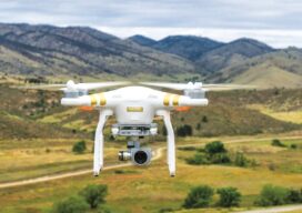
Safety is Paramount in Aerial Drone Mapping
As the Federal Aviation Administration (FAA) prepares to release its ruling covering uncrewed aircraft flights beyond visual line of sight (BVLOS) in the National Airspace (NAS) the entire industry is holding its breath preparing for a new era of certainty and expansion. Aerial photogrammetry will be one of the immediate beneficiaries of this new policy...