All posts by Gavin Schrock
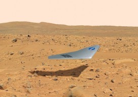
Surveying on Mars
The subject of Mars exploration and colonization is suddenly red hot. What role might there be for surveyors in this, the grandest of human endeavors? Above: The Prandtl-m is a conceptual fixed-wing drone for Mars mapping that will be tested this year from a balloon drop over Earth at an altitude of 35,000m to simulate Mars’...
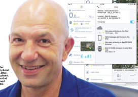
Getting in Touch with Your Inner Bad Elf
Bad Elf: delivering (very) affordable accuracy—simply—for mapping and asset management users. The device is a Bluetooth peripheral GNSS receiver that can feed more-reliable and precise positions to any location-based app on your smartphone or tablet. Having just returned from a visit to Bad Elf’s offices in Scottsdale, Arizona, I was itching to put this little...

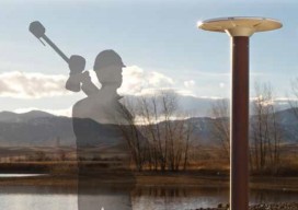
Trimble Catalyst — No Receiver Required*
*A groundbreaking new service turns your smartphone into a high-precision, software-defined GNSS receiver. The new Trimble Catalyst is a little hard to describe in terms we’re used to regarding high-precision GNSS. Is it a receiver? Is it a service? Do we really need only an external antenna, a subscription, and a smartphone? The answer is...

Boom Behind/Boom Ahead: Millennials & Surveying
The outlook for surveying and geospatial services may soon swing up significantly, and being prepared may depend on paying attention to simple demographics. Generational shifts will dictate the types and magnitude of needed services and our ability to attract new practitioners to surveying and geospatial professions. Of course, the future is impossible to completely predict,...
What Is That? The FFOS Needs Your Input
The work of the subcommittee on branding opens many possibilities. Imagine a member of the public: someone who may have never met a surveyor. Or maybe they hired one to mark their property so they could see if a neighbor’s fence is encroaching, or maybe they’ve seen “those people with cameras on tripods” along the...
RTN: Real-Time GNSS Networks Best Practices White Paper
Paper Title: Best Practices for the Development and Operation of RTN – Real-Time GNSS Networks As presented to the Latin America Geospatial Forum (LAGF 2016) – October 5th, 2016 – Mexico City Download here. Abstract: Real-time GNSS networks (RTN) have been a reliable tool for precise positioning, location, and measurement since the late 1990s. From...