All posts by Shelly Cox
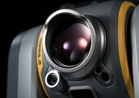
Trimble Unveils SX10 Scanning Total Station
Trimble unveiled a next-generation survey instrument—the Trimble® SX10 Scanning Total Station. It merges high-speed 3D scanning, enhanced Trimble VISION™ imaging technology and high-accuracy total station measurements into familiar field and office workflows for surveyors. The innovative solution provides surveyors and geospatial professionals with the capabilities and versatility to handle projects from traditional surveys to complex...

NSPS Map/Plat Design Competition Winners
2016 Map/Plat Design Competition NSPS is pleased to announce the winners of the 2016 Map/Plat Design Competition and expresses its appreciation for all who participated. NSPS also wishes to thank the judges for their dedicated efforts. Subdivision Plats First Place: Harry Smith – Northeast Surveying, Inc. – Wisconsin Second Place: Kyle Mott – BME Associates...

Autodesk Launches AEC Excellence Awards
AEC Excellence Awards Expands Competition from Infrastructure to Embrace All of AEC Since 2012 Autodesk has sponsored the “Excellence in Infrastructure” competition, recognizing the world’s best examples of the application of BIM for infrastructure projects large and small. Based on the success of that effort, they’re pleased to announce the new AEC Excellence Awards, an expanded...

xyHt Doer: Jeff DeBoer
Jeff DeBoer is program manager of OEM & Mobile Mapping Systems at Topcon Positioning Systems. My main role at Topcon is supporting our customers and working with our mass data collection systems. My responsibilities range from working internally with our engineering teams to help develop and improve products to going out in the field conducting...
Trimble Takes Flight with New Multirotor Unmanned Aircraft System
Latest Addition to UAS Portfolio Makes Working in Tight Spaces Easy Trimble announced the ZX5 Multirotor Unmanned Aircraft System (UAS), a new aerial imaging and workflow solution that captures and processes geo-referenced photo and video data for mapping, agriculture and inspection applications. The Trimble® ZX5 complements the UAS portfolio with the ability to reach smaller,...

Locata Positioning at Langley Research Center
Locata Positioning will Underpin Future Unmanned Aerial System Research at NASA’s Famed Langley Research Center Locata Corporation announced that NASA plans to install a Locata network (LocataNet) as the core positioning technology for safety-critical unmanned aerial systems (UAS) research at its Langley Research Center in Hampton, Virginia. NASA Langley is tasked with performing rigorous and...
