
Blog

Yes, We Scan! KickTheMap is a Swiss Kick in the App for 3D
With a clever mobile app and a can-do attitude, Swiss surveyors have created a 3D model of a river valley in the Alps to improve risk prediction of landslides. The 7 p.m. storm forecast was not only accurate, it was ominous. Torrential rains pounded the ski town of Val Ferret on the final day of...
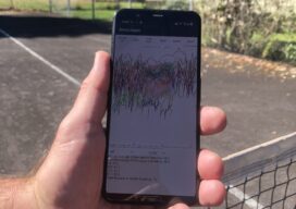
Apps: GnssLogger & Google’s Play in GNSS
GnssLogger? Many surveyors are familiar with the U.S. National Geodetic Survey’s Online Positioning User Service (OPUS), a cloud-based processing service that allows them to upload a Receiver-Independent Exchange (RINEX) file and receive results in minutes. Soon, they may be able to achieve centimeter accuracy by accessing raw GNSS measurements on their Android phone. Google announced...

xyHt Weekly News Links: 10/09/2020
The Need for BIM Standards in Digital ConstructionDrones Will Help Reforestation After WildfiresSmarter GNSS Solutions for SurveyorsSugarbaker Joins Dewberry’s Geospatial and Technology GroupUSGIF Student Diversity AwardsSBG Systems supports Education with IMU, AHRS, INS/GNSS, and PPK SoftwareWoolpert Establishes UAS Hub in New Jersey

Jack Dangermond, Part 4: Field Maps and Stuff
At the Esri User Conference, xyHt European editor Nicholas Duggan sat down for a one-on-one interview with Jack Dangermond, Esri founder and CEO. In Duggan’s five-part online series, running each day this week, Dangermond discusses everything from Esri’s beginning to the future of GIS. Here in Part 4 the two discuss Quantum Navigation and Field...

Geospatial Adventure: Ghost Towns and Diamond Mine Memories
Diamond mine memories: A century or so ago, miners in the small settlement of Pomona pulled 50,000 carats of diamonds a month from the vast, arid nothingness of land called the Sperrgebiet—10,000 square miles of coastal desert in southwestern Namibia in Africa. The sandy ground has long since given up the last of its precious...
The Early Days of 3D Scanning, Part 5
Joining the 3D Laser Scanning Pioneering Start-up, Cyra Technologies Thus far in my “insider story” series (June, July, August, September), I have described how, while working for Trimble in 1996, I first became aware of the technology and Cyra Technologies, a pioneering start-up developing it. After a jaw-dropping demo, I dove into evaluating the technology and Cyra for a...
Advertisement