Category Archives: Aerial/UAS
UAS and ALTA Surveys
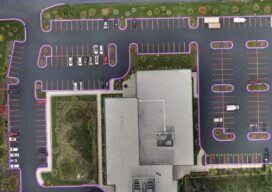
Part 3 Precision, accuracy, and completeness are the end goals of UAS post processing, but how you get there to meet ALTA standards requires extra care. In Parts One and Two of this article in the September and October 2022 issues of xyHt we looked at the time/cost/precision proposition of using UAS for elements of...
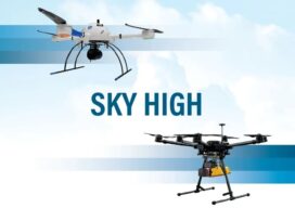
Sky High
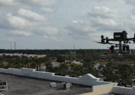
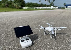
UAVs deliver practical and highly technical mobile mapping Collecting imagery with uncrewed aerial vehicles (UAVs) is ideal for a variety of applications including topographic mapping, forestry ground and canopy measurements, powerline corridor mapping, Digital Terrain Model (DTM) generation, high-resolution digital imagery, and orthophoto production, along with support for a variety of other mapping needs. Historically,...
UAS and ALTA Surveys – Part Two
Surveying firms that have been successful in incorporating UAS data in ALTA surveys adopt best practices to ensure precision standards are met. Plan, execute, and check. In Part One of this three-part series in the September xyHt issue, we looked at the time/cost/precision proposition of using UAS for elements of ALTA surveys. Firms interviewed agreed...

Sponsored Content – OneAtlas: Processing Satellite Imagery in the Cloud
Airbus Intelligence provides users with access to satellite imagery, innovative geospatial analytics, and industry-specific insights. Image data from the Airbus Constellation of satellites, which includes twin SPOT 6/7, Vision-1, Pléiades, and Pléiades Neo satellites are used to deliver actionable intelligence to a variety of markets around the globe. Already known for quick processing and delivery...
In Vegas, a Vision of the Future
If further proof is needed that in-person conferences are back and stronger than ever, just turn to last month’s Commercial UAV Expo in Las Vegas. A record number of attendees spent three days perusing a jam-packed Caesars Forum convention hall looking at everything from long-established Amazon Prime’s latest delivery drone to up-and-coming Fixar’s autonomous fixed-wing...
UAS and ALTA Surveys – Part One
Recognizing that with the right equipment and practices, specifications for ALTA surveys can easily be met, surveyors have rapidly adopted UAS for these and many other types of surveys. The adoption of UAS in the surveying profession has been more rapid than some past tech. It was only 2016 when the FAA Part 107...