The infamous island is under attack by climate change, rising sea levels, and old age. Can scanning it from the sky and on the ground preserve it?
When the first functional photogrammetry uncrewed aviation vehicles (UAVs) became mainstream technology around 2013, geodesists and land surveyors around the world adopted these flying wonders as an innovative way to map certain areas of the globe without having to spend millions of dollars in expensive aircraft and full-format cartographic cameras.
Originally it was the small multi-copters with small-format cameras and limited flying time that caught the imagination of the geospatial professionals, but eventually a new generation of fixed-wing aircraft with heavier useful payloads and longer flying times turned uncrewed photogrammetry from a nice-to-have into a must-have piece of equipment.
A perfect example of why fixed-wing uncrewed aviation is here to stay is the recent mapping of Alcatraz, the small, isolated, infamous island in the San Francisco Bay one mile north of the city of San Francisco.

Doug Wiedman (left), Bill Granados (middle), and Bobby Valentine flew the eBee X UAV on the mission to scan Alcatraz Island from above.
Pete Kelsey, owner of VCTO Labs was the leader of the endeavour, which involved not only aerial images to create a perfect, centimeter-accuracy map of the exterior, but also laser scanners and many other sensors mounted in various crafts to digitally recreate every nook and cranny inside of the macabre prison.
Kelsey and I worked together at Autodesk in the 2000s when the software company was seriously investing in creating products for geospatial professionals. It was an exciting time to be in the industry because hardware vendors were manufacturing land surveying instruments capable of producing millions of highly accurate points per second. The bottleneck in those days was the software to turn these point clouds into actionable information and the computing power to process the massive amounts of data, which was seriously lacking.
We reached out to Kelsey for an exclusive conversation about his effort to map Alcatraz, now part of the Golden Gate National Parks Conservancy, to preserve it digitally for future generations.
“The idea came to me because of my love for national parks and the fear that climate change, specifically in the San Francisco Bay area will erode this historical monument before we have time to document every piece of it for posterity,” Kelsey said. “We set out to assemble a team of experts (see chart) in aerial mapping and ground laser scanning that would collaborate, for a non-for-profit effort to create a digital model of the entire island with centimeter accuracy.
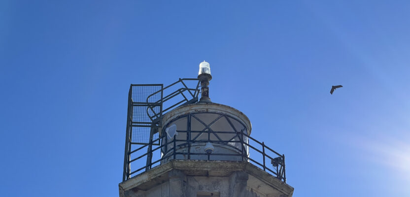
Infamous for the maximum-security prison that once held the likes of Al Capone, George “Machine Gun” Kelly, and Robert “Birdman of Alcatraz” Stroud, the island was a military fort in the 1850s, home to the first lighthouse on the West Coast, and an important bird-nesting habitat.
 “I love national parks, and I’m always looking for ways to help them out. I have worked in many, including the USS Arizona, Dinosaur National Monument, etc. The National Park Service (NPS) was keen to understand the effects of sea level rise on the island, so we decided to help. For a national park, Alcatraz was manageable in terms of size (22.5 acres).”
The team spent three weeks in December 2023 using an AgEagle eBee X, laser scanners, and a robotic dog. The selection of the aerial platform was based on the fact that the eBee X is a National Defense Authorization Act (NDAA) drone and only NDAA UAVs are allowed for use within the NPS properties. It is also cleared to fly over people and was used basically to capture photogrammetry and multispectral data.
“To me the greater story is that there has never been a gathering of state-of-the-art sensors as there was for this project—all tied into a survey control network,” Kelsey says. “There has never been this kind of cooperation on a project from competitive vendors, all showing up at their own expense and focusing on the solution of capturing every space on Alcatraz, inside and out. AMD even donated a supercomputer for the post processing. The data is nothing short of spectacular.”
 In about 21 days of data collection, the team gathered about four trillion bytes of data to build the first 3-D map of the entire island in full color. The resulting product will be an invaluable tool for local organizations to track the potential effects of climate change, not only on the island, but also throughout the San Francisco Bay area. NPS officials can now visualize potential flooding at Alcatraz and protect the island against future damage.
“We used a lot of different sensors, for example the camera Sony A7RIV, a Phoenix LiDAR Ranger 120, 2x Emesent Hovermap ST-X’s, Riegl VZ 600i, Riegl VZ-2000i all tying to a survey control network of more than 70 ground control points that came in at three millimeters. On the eBee X, we flew the Duet M, an innovative dual-purpose RGB and multispectral mapping camera rig. We used it to create geo-accurate multispectral maps and high-resolution digital surface models (DSMs) of the external structures.”
As usual, we tend to romanticize field work. When asked about the challenges of spending three weeks on Alcatraz, Kelsey was explicit in his recollection of the event.
“Access was the first roadblock,” he said. “There are a lot of pad locks, locked doors, locked cells on Alcatraz. Being given the keys to the island was the single most important fact to the project’s success.”
Not disrupting visitors and staff while the team was working was also a key component of the project. This is why we slept in cells on the island for three weeks, so we could be up early working before the first staffers and visitors arrived. We had to bring in all our own food as no food is allowed on the island. So, it was camping. No showers, no hot water.
“The first night the bugs ate us alive in our cells. I went into San Francisco and bought every mosquito net I could find to put over our bunks in the cells. We got very lucky with the weather. On the days we had marked to fly, the weather was perfect. This was a bit of a miracle as San Francisco Bay in December is typically wet, cold, and windy.”
Like many National Park Service properties, Alcatraz is at risk on numerous fronts. It faces a possible earthquake. It is vulnerable to fires or floods. It also suffers from plain old wear and tear from its 1.5 million annual visitors, with some of its buildings and equipment badly deteriorating.
While the UAV flew over Alcatraz, much scanning was taking place inside the “The Rock,” including in some creepy places.
 “The most disturbing part of Alcatraz to me is the hospital. The prison doctor was a drunk. The holding cells in the hospital for the psychiatric patients were particularly disturbing. It was right out of The Shining. We scanned all of it, but no one really liked being in there. Very spooky. I just kept imagining the screams,” Kelsey said somewhat graphically.
The interior scans were completed with two Emesent Hovermaps and with Riegl vz 600i and vz 2000i terrestrial laser scanners. The results produced about 200 individual scans that have to be cleaned, colorized, and merged with the drone-based lidar and all tied into the survey control network, which came in at three millimeters across the entire island.
“We are deep into the postprocessing now and parts of Alcatraz are revealing themselves that have never been seen by any living person,” Kelsey said.
We asked him what was particularly eerie about being in such infamous place for so long.
“The north gun gallery where the Battle of Alcatraz began in 1946 was fascinating.” Kelsey said. “There is graffiti there from the guards and the rioters who took over the gun gallery. The graffiti left by the rioters is particularly pornographic. There are bullet holes from the battle up there. We scanned all of that, too. The gun gallery is off limits to visitors so scanning areas like this that someday might be made available for virtual tourism and study is exciting.”
When asked about the timeframe and restrictions on the amount of days they could stay, Kelsey was clear about the timing.
“We had three weeks to complete the data capture,” he said. “This would not have been possible without the cooperation of the entire team. Team members who might typically view other team members as competitors out in the workplace tabled all of that and came together to focus on the project, the workflow, the interoperability. It was amazing; a once-in-a-lifetime gathering of talent and technology. All credit goes to the team. I cannot thank them all enough.”
The National Park Service will maintain the rights to the 3-D map, and no money changed hands in the making of the map.
“I believe the 3-D map provides the National Park Service with endless opportunities,” Kelsey says. “It could be used by movie studios, which wouldn’t need to film on Alcatraz but could instead use the 3-D data with a green screen. It could be turned into a video game or a virtual reality experience using Apple Vision Pro or Meta headsets. It could be replicated with a 3-D printer. My selfish dream is that it’s the world’s first virtual national park.”