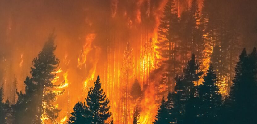
The destructive threat of wildfire is a global concern. In 2022 Germany recorded 2,397 wildfires with a size of more than 3,058 hectares (7,556 acres) of destroyed forests.
To address this threat, an ongoing research project—initiated by Landkreis Goerlitz (a county in the state of Saxonia) and the Ministry for Digital Matters and Mobility (BMDV)—Germany in cooperation with GGS, a German geospatial services firm, focuses on monitoring an overall forest area of 170 square kilometers (66 square miles) in Northeast Germany.
 The goal was to determine the viability of using geospatial tools, including aerial surveys with both fixed-wing and UAV platforms enabled with AI and 5G, to create three vital tools:
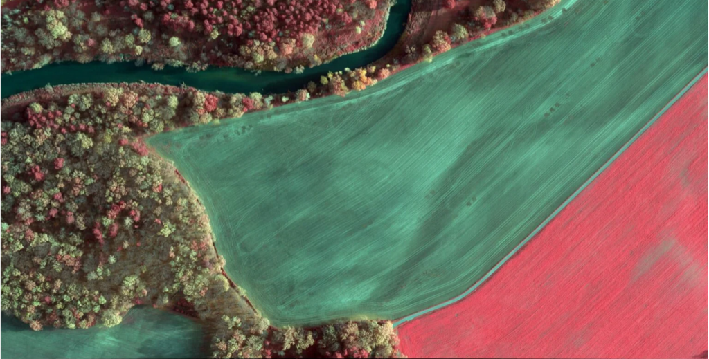
Forest health assessment: The RGB, NIR, CIR (colored infrared), NDVI (normalized difference vegetation index) and Red Edge (vegetation in NIR) orthophotos are used by forest experts to detect high-risk areas for wildfires, areas suffering from drought or diseases—such as the bark beetle—or to evaluate soil health status.
Emergency maps: The RGB orthophotos are used as part of the emergency navigation system for firefighters in combination with other information e.g., the ease of access of paths, lakes for accessing water, information on infrastructure as well as areas that are inaccessible for a variety of reasons.
3D simulation: The 3D data from the oblique cameras is used to generate a perfect 3D model of the area and is being processed with Skyline’s Photomesh software. Skylines Terra Explorer Software performs analytics in the surface model, e.g. visual line of sight of the observation towers and optimized UAV flights to detect fire nests.
To enable these tools, three technologies were employed:
Aerial camera configuration: The camera setup for the survey was based on GGS’s OIS-Technology with an addition of NIR and thermal cameras. The Phase One iXM-RS 150 with a 90 mm lens for Nadir imaging was selected. Two additional Phase One Achromatic iXM-100 cameras with NIR filter (band 700-850 nm and 750-850 nm) and two 70 mm lenses were added.
For generating a 3D surface Model, four Phase One iXM-100 oblique cameras each equipped with an 80 mm lens were also integrated into the camera pod. Alongside the Nadir cameras, two further thermal cameras capture the entire footprint with lower resolution to indicate the influence of micro-climate changes on the forest health.
Observation towers: Three observation towers are available within the target. Upgrading the towers is the next step. An innovative camera array capturing RGB, NIR, AC and Thermal data—which are mounted on a gimbal—will be installed on two towers. The gimbal is scanning the area at 270 degrees while the cameras are taking images with a 60% sidelap. Captured data will be streamed via 5G to a server (central crisis management server) and analyzed using AI algorithms to detect wildfires.
UAV deployment:Smaller areas can be monitored with UAVs equipped with RGB, NIR and Red Edge cameras. To provide a long flight time, these UAVs only carry small format compact cameras. After an alarm is received, a single UAV will be deployed. In certain situations, a UAV swarm may be sent out to observe for additional fire nests.
The research project is ongoing, yet it looks like the team has developed a powerful tool kit for assessing forest health and thus predicting where wildfires may be likely, as well as providing imagery data to detect, monitor, and mitigate ongoing wildfires. See the Phase One website for the full case study.