Category Archives: GNSS/Location Tech
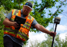
GNSS rover developments give surveyors a new edge
Chris Trevillian describes the Trimble R12i GNSS receiver with ProPoint engine with tilt compensation and calibration-free operation for flexibility, traceability and robustness
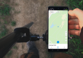
ReachView 3: Native App for Reach Receivers
ReachView 3 is the new mobile app by Emlid for working with Reach RTK receivers. Familiar point collection and stakeout tools are now powered with the new user interface, coordinate system support, and ability to manage big projects. It is a free app available for Android and iOS devices. Coordinate Systems on Board In ReachView...
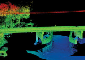
The Challenges of Near-shore Hydrographic Surveys
Near-shore hydrographic surveying can be a challenging task, especially if the conditions are not ideal to collect the required data.

The Early Days of 3D Scanning: Part 8
In multiple ways, 1999 turned out to be a pivotal year for Cyra Technologies and for 3D laser scanning, in general.
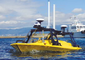
All Hands on Deck
Mapping the entire U.S. seafloor is an epic task. The country’s new national hydrographer says it can be achieved by coordinating efforts and using the latest technology.
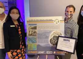
MAPPS 2020 Geospatial Excellence Awards
MAPPS honored members with the 2020 Geospatial Excellence Awards as part of the organization’s 14th annual Awards Presentation that took place January 26, 2021. The event was hosted by Riegl USA in conjunction with the 2021 winter meeting in Orlando, Florida. The Geospatial Excellence Awards are presented to regular and associate member firms whose entries...