Category Archives: Magazine

xyHt Magazine June 2019 Issue
Click on the cover below to view the June 2019 issue of xyHt magazine. Articles in the issue include (links will turn live throughout June): A Truly Unique Scanner – A look at innovation in hardware, software, and workflow in the Leica RTC360. World’s Biggest Digital As-built? – A whopping 1.5-million square feet of a...

xyHt Magazine May 2019 Issue
Click on the cover below to view the May 2019 issue of xyHt magazine. Articles in the issue include (links will turn live throughout May): Embrace the Mesh – Surveyors and photogrammetrists capture reality data. But to model, manage, and provide access to massive and complex datasets—to provide your clients with true 3D mesh reality capture—you’re...

xyHt Magazine Heights 2019 Issue
Click on the cover below to view the Heights 2019 issue of xyHt magazine. Articles in the issue include (links will turn live throughout April): Mapping Alaska with IFSAR – A group of companies overcomes Alaska’s many mapping problems using coordinated teamwork and IFSAR. Airports GIS – The history and complexities of AGIS from the expertise of a...

xyHt Magazine April 2019 Issue
Click on the cover below to view the April 2019 issue of xyHt magazine. Articles in the issue include (links will turn live throughout April): A New Mix – Mixed reality for infrastructure and geospatial takes a huge leap forward with the announcement of the HoloLens 2, SYNCHRO XR, and the XR10. Logic inside the BIM Labyrinth – An...

xyHt Magazine March 2019 Issue
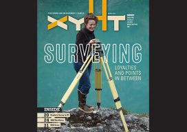
Click on the cover below to view the March 2019 issue of xyHt magazine. Articles in the issue include (links will turn live throughout March): GPS Week Rollover – Don’t Panic (Update) – This article explains what the GPS Week rollover is and why it is of interest or concern to GPS users. Surveyors: Loyalties and...

xyHt Magazine February 2019 Issue
Click on the cover below to view the February 2019 issue of xyHt magazine. Articles in the issue include (links will turn live throughout February): Aerial Self-sufficiency – A large risk-assessment and data-analytics company created its own internal system to collect imagery, write software, and develop processing workflows. Sydney’s Paleovalley in 3D – Tunneling under Sydney Harbour for...
