Tag Archives: 3d mapping

xyHt Weekly News Recap: 04/28/2023
Topcon Launches Easy-to-Use Building Construction Software Digital Construction Week Reveals Main Stage Lineup OGC Requests Public Comment on a Standardized Deformation Model and a Geodetic Data Grid Exchange Format AUV Helps Locate World War II Ship 80 years After Tragic Sinking Bluesky and Ecopia Partner to Create First 3D Map of Ireland Get Special Hotel...

Built for Danger
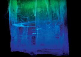
While the operator stays safe, indoor drones carrying lidar and SLAM technology create a 3D map of the inside of hazardous spaces Nuclear power plants, ballast tanks, underground mines, toxic chemical plants, sewers, offshore oil storage, decommissioned industrial facilities—none of these are places suitable for humans; yet monitoring and inspection of the interiors are often...

Ready, Re-set, Go
Post-pandemic digital transformation was on everyone’s mind at INTERGEO. With its mojo back, the world’s biggest geospatial trade event can once again offer the best geo-business innovations to get you all set for 2023. Germany’s annual INTERGEO event is the CES of the geospatial industry. If its Las Vegas counterpart is high on consumer electronics,...

xyHt Weekly News Recap: 09/30/2022
Teledyne and Seabed 2030 to Study Impacts of Volcanic Eruption in Tonga Greater St. Louis, Inc. Wins Esri Special Achievement in GIS Award Bluesky Takes to the Skies to Capture More Oblique Views of UK Cities Bentley, Genesys to Provide 3D Mapping Capabilities for Cities across India Free Webinar: What’s the Latest in Survey and...

xyHt Weekly News Recap: 12/03/2021
2022 GeoWeek Awards Topcon opens new European distribution center in Zoetermeer Bluesky Aerial Photography used to Map Green Roofs NSPS Scholarship Applications Available LiDAR Market May be Worth $3.4 Billion by 2026 Capturing the Environment with a Lidar-equipped Helmet Advanced Aerial Mapping Provides Valuable Information to First Responders Generation of 3D Maps Placed in the...

xyHt Weekly News Recap: 11/12/2021
Fugro Launches New Generation of Uncrewed Surface Vessels Teledyne Geospatial to Showcase Hardware and Software Solutions at Geo Business 2021 Trimble Establishes Dr. Gladys West Scholarship Program Woolpert Selected to Collect Aerial Lidar Data for Ohio 3DEP Women in Technology Nominations Due by Dec. 31 Bill Introduced to Reform National Flood Insurance Program First American...
