Tag Archives: cartography
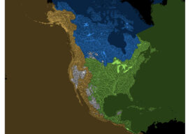
How Our Continent Drains
Robert Szucs is a digital cartographer turned artist who saw the potential to turn nature’s patterns into contemporary artwork. This ocean drainage map was a months-long project, that included “a ton of manual work,” including cleaning data, figuring out how to categorize millions of lines into a handful of ocean drainages, and then zooming in...
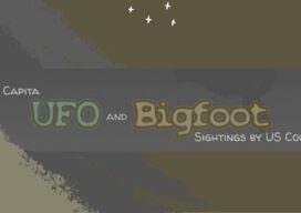
Tracking the Paranormal
Mapping Your World Ever wonder where Bigfoot hangs out? What about where most UFOs fly by? Explore both with this per capita UFO and Bigfoot sightings map. The map by Kate Berg, which is featured in the 2023 GeoHipster calendar, cross references sightings of both by county. See what trends or patterns you glean from...

Sara Thompson
23 Young Geospatial Professionals to Watch in 2023 – 21 of 23 Name: Sara ThompsonCompany: Arizona Department of Transportation Current position: Geospatial Analysis Section ManagerAge: 25 Education: BS in Conservation Biology and Ecology, Arizona State University; Certificate, GIS and Cartography, Arizona State University Thompson is a geospatial leader making a difference for young professionals across multiple...
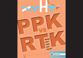
xyHt Magazine Digital Edition: December 2021
Like a good surveyor, xyHt‘s December issue covers a lot of ground. This month we bring you stories about surveying, lidar, legal issues and an in-depth look at the emerging post-processing kinematic technology. As always, if you don’t have a subscription to our print edition, or if someone else in the office has snaffled your copy,...

xyHt Weekly News Links: 10/16/2020
How UAVs Make a Difference in Modern ForestryNew Topcon Robotic Total StationEarth Define Maps U.S. TreesNASA to Study Trees Impact on Remote SensingHxGN Content Program delivers airborne DSM to the Federal Agency for Cartography and Geodesy (BKG)Ronda Schrenk to Serve as USGIF Foundation CEO
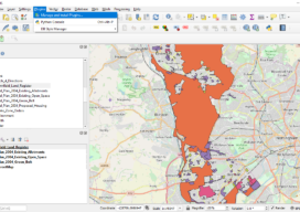
Creating a Web Map Using QGIS2Web
Almost two years ago to the day I wrote Webmapping 3.5 in which I did a walkthrough of QGIS2Web. Since then, QGIS has grown up, and so has QGIS2Web. In the original blog, I discussed how you could use OpenLayers and Leaflet as basemaps. Now you can use Mapbox, too. The layout is improved and...