Tag Archives: xyHt

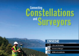
xyHt Digital Magazine: April 2022
Like a good surveyor, xyHt‘s March issue covers a lot of ground, bringing you stories about surveying, mapping, UAVs and, this month’s special, a look at how drones are becoming indispensable on construction sites. As always, if you don’t have a subscription to our print edition, or if someone else in the office has snaffled your...

xyHt Weekly News Recap: 04/01/2022
Flood Protection Program Virtual Industry Day Set for April 21 Synspective, World Bank, and NDRRMA Assess Geohazards after Flood in Melamchi, Nepal Qualcomm, Trimble Introduce Meter-Level Location Accuracy for Smartphones India Undertakes Large-Scale Bathymetry Survey to Develop Coastal Economic Zone Intermap Supports Ukraine’s Ministry of Defense with High-Resolution Analytics CompassCom Announces the Launch of Compass.University...

xyHt Weekly News Recap: 03/25/2022
Congress Passes Act to Modernize Access to our Public Land NSPS Virtual Day on the Hill is March 30 Qualcomm and Trimble Introduce Meter-Level Location Accuracy for Smartphones ProStar Announces Trimble Integration of PointMan for Apple iOS University of Plymouth and Sonardyne Advance Development of Marine Monitoring Technology JOIN and DMP to Create High-Definition Map...

xyHt Weekly News Recap: 03/18/2022
GEO Business is back on 18-19 May Miller-Wenhold Provides Tips for Planning National Surveyors Week Activities Electric Construction Machines Vital for Cleaner and Greener Construction, Says IDTechEx RapidDeploy brings modern mapping and analytics to emergency response in Minnesota InterGeo 2022 to be Held in Essen, Germany AUVSI Commends Safety Focused UAS BVLOS Rulemaking Committee Report ...

xyHt Weekly News Recap: 03/11/2022
David Applegate Nominated to Head USGS Subsurface Utility Mapping Strategy Forum and Workshop March 22-25 Terradepth Launches Absolute Ocean to Map the World’s Oceans XMAP GIS Tool Aids UK Government’s £2 Billion Active Travel Schemes Innovations that Power Your Operations Headline Sonardyne’s Theme for Oi2022 Register for Global Surveyors Day Register for Carlson’s Go West...

xyHt Weekly News Recap: 03/04/2022
Register for the March 30 NSPS Day on the Hill Carlson Go West 2022 Set for April 4-6 ProStar Granted Major Patent for Utility Data Management RIEGL & Deswik: Providing a Fast and Efficient Workflow for Mine Surveying Emesent Hovermap Sets Survey Grade Standard for Autonomous Lidar Mapping NCEES Seeks Professional Surveyors’ and Mapping Scientists’ Expertise...
