Tag Archives: xyHt

xyHt Digital Magazine: July 2022
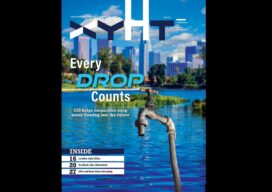
xyHt’s July issue focuses on Geographic Information systems, looking at how GIS helps surveyors improve accuracy and how GIS is the technology for the next era. As always, if you don’t have a subscription to our print edition, or if someone else in the office has snaffled your copy, don’t fret, here is the digital...

xyHt Weekly News Recap: 07/01/2022
Letitia A. Long to Receive 2022 Lundahl-Finnie Lifetime Achievement Award Nation’s First Drone-on-Demand Mobile App Now Downloadable on All Devices Cartegraph Launches Right-of-Way Permitting Solution for Local Governments Airbus awarded FORUM Earth monitoring satellite contract from ESA South Korea launches KASS satellite to augment GPS SUE Association Announces National Conference Esri to Donate Software for...
xyHt Weekly News Recap: 06/24/2022
Bluesky LiDAR Data Helps Farmers Apply for Carbon Credits NV5 Acquires GEO1, Expands Position in Electrical Utility Geospatial Solutions SimActive Releases Version 9.2 with Phase One IIQ Integration Satellite Mapping of Shallow Waters of Belize is Largest Caribbean Survey of its Kind Esri Safety and Security Summit to Showcase Building Resilient Communities Commercial UAV Expo...
xyHt Digital Magazine: June 2022
Like a good surveyor, xyHt’s June issue covers a lot of ground, bringing you stories about hydrography, geographic information systems, lidar and location data. As always, if you don’t have a subscription to our print edition, or if someone else in the office has snaffled your copy, don’t fret, here is the digital edition. Click here or...
xyHt Weekly News Recap: 05/27/2022
New Energy Performance Data in XMAP Helps Tackle Climate Change Trimble Introduces High-Accuracy OEM GNSS Receiver Module Atmos Integrates Topcon Hardware to Create All-in-One Surveying Solution Fugro’s Lidar Geo-Data Supports OPW’s Irish Coastal Resilience Strategies Censys Technologies and American Aviation Regulator Complete BVLOS Emergency Response Project Applications Invited for URISA’s Vanguard Cabinet (URISA) Australian Company...
xyHt Weekly News Recap: 05/20/2022
The NSPS Foundation announces the 2022 Scholarships Major Geospatial Intelligence Asset Added to St. Louis’ New Innovation District Webinar: A Surveyor’s Perspective of Mobile Mapping Phase One Announces Next-Generation Aerial Solutions Enhanced with Near Infrared Capabilities Leica Geosystems Opens Nominations for Carl Pulfrich Award 2022 Program Set for Commercial UAV Expo 2022 URISA’s Vanguard Cabinet Announces 2022...