All posts by Jeff Thoreson
URISA Announces 2022 Digital Competition Results
URISA’s Vanguard Cabinet is pleased to announce the results of the 2022 Student and Young Professional Digital Competition. Eligible participants were currently enrolled in a college or university, a recent graduate, or a young or emerging geospatial professional with fewer than five years of experience. The competition was limited to projects that utilize web and mobile platforms, such...
xyHt Digital Magazine: August 2022
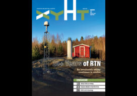
xyHt’s August issue focuses on location technology, looking at the 20-year history of Global Navigational Satellite Systems and how it has changed the surveying profession and been the catalyst for other geospatial disciplines to emerge. As always, if you don’t have a subscription to our print edition, or if someone else in the office has...

xyHt Digital Magazine: July 2022
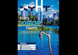
xyHt’s July issue focuses on Geographic Information systems, looking at how GIS helps surveyors improve accuracy and how GIS is the technology for the next era. As always, if you don’t have a subscription to our print edition, or if someone else in the office has snaffled your copy, don’t fret, here is the digital...
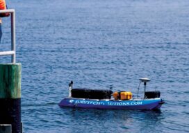
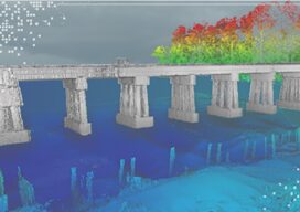
No Barrier Between Land and Water
Innovative tools and technology help hydrographic mapping deliver detailed data in previously inaccessible areas. Underwater mapping presents unique logistical challenges that are increasingly being met with technology used in creative ways, and by combining multiple types of data to develop a complete picture. From unmanned surface vessels (USV) to multi-beam sonar, advanced equipment yields accurate...
xyHt Digital Magazine: June 2022
Like a good surveyor, xyHt’s June issue covers a lot of ground, bringing you stories about hydrography, geographic information systems, lidar and location data. As always, if you don’t have a subscription to our print edition, or if someone else in the office has snaffled your copy, don’t fret, here is the digital edition. Click here or...
Teledyne Forms New Geospatial Company
Teledyne Optech and Teledyne CARIS have united to form the new Teledyne Geospatial, offering holistic solutions to seamlessly map land and sea through the integration of industry-leading lidar sensors and world-renowned software workflows. This collaboration empowers customers with a competitive edge in mapping and delivering data products inside of one complete workflow.Ease of collection and...