All posts by Jeff Thoreson
GIS Related Conversation with Chat GTP 3.5
September 23, 2023 Which Geographic Information Systems software are you familiar with? ChatGPT: I’m familiar with a variety of Geographic Information Systems (GIS) software packages that were available up to my knowledge cutoff date in September 2021. Some of the commonly used GIS software include: ArcGIS by Esri: ArcGIS is one of the most widely...

Looking Forward: Scanning History
Looking Forward On a family cruise to Mexico several years ago, I was intent on seeing the Mayan ruins at Tulum. It required a 45-minute ferry from Cozumel to Playa del Carmen and then an hour bus ride to the ruins. With the palm trees, warm Caribbean December breeze, white-sand beaches, and warm aqua water...
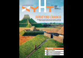
xyHt Digital Magazine: April 2023
xyHt’s April issue focuses on surveying, including modern technologies being used in a massive geophysical survey and historic equipment that got the profession to where it is today. As always, if you don’t have a subscription to our print edition, or if someone else in the office has snaffled your copy, don’t fret, here is the...
Construction on the Move
Looking Forward From the very first construction project (possibly the addition of an extra room on to a Neanderthal cave) until the late 20th century, construction technology moved at a glacial pace. But in the last few decades, especially the last decade, innovation has taken off. And if you think the changes in the most...

xyHt Digital Magazine: March 2023
xyHt’s March issue focuses on construction and the geospatial technologies that are changing the way we build things. As always, if you don’t have a subscription to our print edition, or if someone else in the office has snaffled your copy, don’t fret, here is the digital edition. Click here or on the cover to the right, to...
Looking Forward: Trying to Predict 2023
Over the course of my decades of participating in the world economy, I have found it useful to not pay too much attention to prognosticators, the so-called (and often self-called) experts. I have come to realize that these folks are about as accurate at forecasting the long-term economy as the weather folks are of forecasting...