All posts by Jeff Thoreson
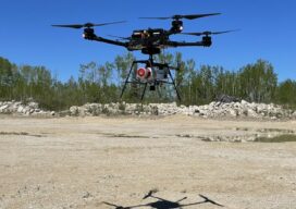
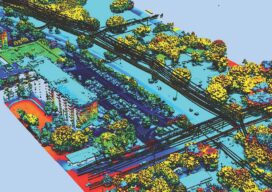
Fusing Aerial and Mobile Lidar Data
Creating accurate as-builts of a complex facilities is no longer a long-term project. When the Caltech Group was founded by two men in Calgary, Alberta, in 1990, they set out with the goal of becoming Western Canada’s go-to company for geomatics services with an eye on specializing in the oil, gas, and utility areas—those companies...

Woolpert Blends Methodology with Technology
What began as a four-person engineering and survey company in Ohio in 1911 has steadily evolved to become a full-service architecture, engineering, geospatial (AEG), and strategic consulting firm, with more than 1,600 staff and 60 offices on four continents. This fusion of AEG data breeds innovative products and solutions that address complex challenges worldwide, providing...
Solving the Problems that Matter
Pickett and Associates provides aerial LiDAR and imagery, land surveying, hydrographic surveying, and engineering services to clients throughout the U.S. and Caribbean. Pickett specializes in offering the simultaneous collection of high resolution 4-Band Aerial Imagery together with engineering-grade airborne LiDAR, allowing us to turn around baseline imagery and LiDAR-derived data quickly and efficiently. We deliver...

Located to Mobilize Anywhere in the Continental U.S.
Midwest Aerial Photography is growing to meet our customers’ needs. Celebrating 32 years in business this year, we are capable of deploying a highly-skilled airborne data collection crew equipped with industry leading digital acquisition technology to any location in the United States and much of Canada on short notice. We take pride in our ability to...
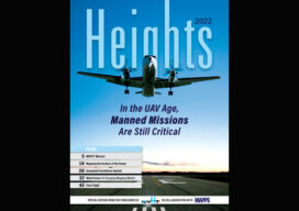
xyHt Magazine Heights 2022 Issue
Click on the cover to view the Heights 2022 supplement to xyHt magazine. Articles in the issue include: Mapping the Ocean: The need to map the surface of the ocean might seem odd, but as aerial technology advances, it is becoming more and more important. Manned Missions: In the age of unmanned aerial vehicles, the roll of the...
Looking Forward: Air, Space, and Ground
This is my favorite time of the year here at xyHt. We bring you not only the regular issue, but our annual Heights supplement, created in conjunction with our friends at MAPPS to address all things aerial. The history of aerial photography is relatively brief. But in that time, technological advances have covered a lot...