All posts by Sara Furlong
Drone Surveying in the Ozarks
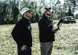
Crafton Tull, an engineering and surveying firm, was tasked with the daunting job of surveying up to 160 acres to collect data needed to design a new road through the heart of the Ozarks. Professional surveyors can face intense challenges—especially when they need to complete large, complicated jobs in dangerous terrain. That’s the situation that...
Drones & Surveying Flood Zones
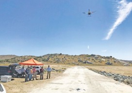
In Juniper Flats, CA, county land surveyors use UAS to save tax dollars and project times and to improve public safety. Photo above: Steven Lewis, Trish Ortega, Paul Clements, Claudio Padres of RCFC & WCD; Sebastien Borghini of Microdrones; Dan McMahon of Allen Instruments. Joshua Tremba does a lot of mapping; he’s the supervising land surveyor...
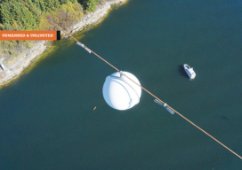
Inspecting Over the Line With UAV
One of British Columbia’s first aerial inspection firms takes on a challenging maritime mission using a UAV. Featured image: The Raecon team flies a UAV across the Strait of Georgia, performing an aerial power line inspection. AS DAWN BROKE off the Sunshine Coast of British Columbia, Canada, the Raecon Industries team set out by boat...