
Blog

A Lost Year? Maybe Not
As we pass the one-year mark of being thrown into a life of facemasks, homeschooling, toilet paper shortages, and isolation from family, friends, and coworkers, it is almost difficult to remember what pre-COVID “normal” was. We have all been impacted on some level, some much more than others, including the loss of loved ones. If...

xyHt Weekly News Recap: 03/19/2021
Extensis Offers GeoViewer Pro at No Charge Esri Joins Digital Twin Consortium DroneUp Acquires Web Teks Insight Lidar Updates High Resolution FMCW Lidar Sensor Bad Elf, ProStar Partner in Surface and Subsurface Technology NSPS will Host ‘Virtual Day on the Hill’ Don’t Forget Global Surveyor’s Day March 23 USGIF and the Geospatial Intelligence Tradecraft

Not Your Father’s Construction Industry
The construction industry, one of the oldest and largest, plays a central role in the development and economic growth of industrialized nations.
xyHt Weekly News Recap: 03/12/2021
Optibus Launches Effort to Help Urban Mobility New Leica CityMapper Improves Digital Twin Creation TII, Purdue University Partner on UAV Security Project Allvision IO Offers Asset Information and Tracking Solutions
xyHt Weekly News Recap: 03/05/2021
Tensing Recognized as Esri Utility Network Specialist Forum Will Explore the Geospatial Metaverse USGIF Board of Directors Appoints New Chair Concept3D Helps Struggling Tourism Industry Lidar Improves Port Efficiency Sanborn, USGS Partner on Arizona Lidar Project Global Surveyors’ Day is March 23 Woolpert Acquires CivilTech Engineering in Expansion
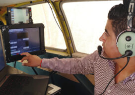
Using Lidar to Strengthen Ground Control
With the maturity of aerial photogrammetry in the early 1900s in pre-war Germany, military applications, especially reconnaissance and semi-accurate 3D maps and approximate contour lines, became the norm.
Advertisement