
Blog
The (Android) Empire Strikes Back: Mainstreaming Augmented Reality, Part 2
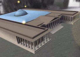
Let’s pick up the AR thread again and look at what the Android platform has to offer in augmented reality (AR). It was just a matter of days after Apple rolled out its ARKit SDK (software development kit) when Google followed suit with its ARCore SDK. ARCore is built on Tango technology but expands the...
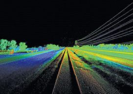
Unmanned Lidar in the Air
A discourse on UAV lidar from the perspectives of a vendor and a user. IS A UAV LIDAR SYSTEM REALISTIC? While UAV lidar is definitely a breakthrough for vendors and users alike, is it enough? Can UAV photogrammetry deliver what is really needed by the surveyor and engineer? Indeed it can, but only in part....
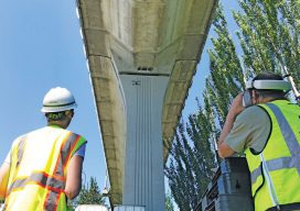
Organic Integration of UAS in the Pacific Northwest
A mapping and design firm in the Pacific Northwest implements UAS in diverse urban and rural environments. Editor’s Note: Integration (or not) of UAS by geospatial firms runs the gamut from outright dismissal of the technology, to firms taking a wait-and-see stance, to companies subcontracting out UAS services. Then there are those, like the mapping and...

xyHt Weekly News Links: 10/6/17
INTERGEO 2017 successfully closes Topcon showcases ‘The Intersection of Infrastructure and Technology’ solutions at INTERGEO 2017 Rex is Here! LAStools Win Big at INTERGEO Taking Home Two Innovation Awards Hexagon Acquires Luciad, a Leading Provider of 5D Visualisation and Analysis Solutions
Destiny: I Was Meant to Be a Surveyor
Even though I didn’t realize it at the time, I had two experiences in my youth with direct links to me becoming a surveyor. Were they omens or simply coincidences? There’s no way of knowing, but I like to think they were part of my early survey indoctrination. My father was a high school teacher,...

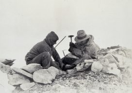
Sputnik and Infrastructure
Today is the 60th anniversary of an event that both enlightened, and, in some ways, frightened the world. But it greatly inspired the worlds of science, engineering, and education. And it also sparked, arguably more than any other single event, developments for the geospatial professions and industries. On October 4th, 1957, a tiny polished metal...
Advertisement