
Blog

The Fangs and the Damage Done
By Cooper Ferko Introduction: Surveyors encounter dangerous situations in the field, and this includes wildlife. We’ve all had our snake encounters, venomous and non. There was a time when I was cavalier about it, flicking a snake away with a range pole. But that all changed around a campfire, at my cousin’s family camp near...

Surveyors and Appellate Court Opinions
Why should we care about appellate court opinions? I have had this question posed to me on numerous occasions. I suppose it has its roots in the old surveyor’s saw: “We don’t need to read court decisions, because you can never know what the judge is going to do.” While this may have a grain...

xyHt Weekly News Recap: 06/24/2022
Bluesky LiDAR Data Helps Farmers Apply for Carbon Credits NV5 Acquires GEO1, Expands Position in Electrical Utility Geospatial Solutions SimActive Releases Version 9.2 with Phase One IIQ Integration Satellite Mapping of Shallow Waters of Belize is Largest Caribbean Survey of its Kind Esri Safety and Security Summit to Showcase Building Resilient Communities Commercial UAV Expo...
xyHt Weekly News Recap: 06/17/2022
IMAGINiT Develops Additional Time-Saving Utilities for Autodesk Revit Surveying Shallow Water from Space Trimble Introduces OEM GNSS Receiver Module for Industrial Autonomy Applications Geo Connect Asia 2022 Hosts Close to 2,000 Professionals from 36 Countries Drone Nerds Introduces Advanced Mapping and Surveying Solution, the ViDoc RTK Rover Expedition to Deepest Point on Earth Will Collect...
No Barrier Between Land and Water
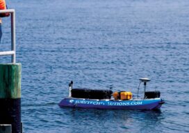
Innovative tools and technology help hydrographic mapping deliver detailed data in previously inaccessible areas. Underwater mapping presents unique logistical challenges that are increasingly being met with technology used in creative ways, and by combining multiple types of data to develop a complete picture. From unmanned surface vessels (USV) to multi-beam sonar, advanced equipment yields accurate...

What to do With All the Lidar Data
An age-old Aesop’s Fable adage says, “Be careful what you wish for, lest it come true!” When the U.S. Geological Survey (USGS) embarked on the National Enhanced Elevation Assessment (NEAA) in 2012, the goal was to document the national-level requirements for enhanced elevation data. Little did USGS know at the time, the report would be...
Advertisement