Category Archives: Aerial/UAS
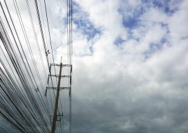
Powerline Inspection
Drone? Ground? Helicopter? For years now drones, UAVs, UASs or whatever you wish to call them have been the revolution that promises to change the way we live. Five+ years into the drone revolution we are seeing some change—but it has certainly been a slower progression than expected. Linewise Aerial specializes in transmission line inspection...
Low-cost Tech for Aerial Archeology, Part One
Last February we took a look at how airborne lidar is revolutionizing the science of archeology in Lidar and The Lost City of the Monkey God. Lidar is nothing less than a godsend for the search for lost cities and civilizations. But it comes at a price, one that cash-strapped archeologists can’t always afford. I’d...
Improving GNSS in the Urban Canyon
To prepare you for the this blog post, I wish to point out that I am a geospatial expert and can hold my own around the ins and outs of survey, so going to an event at the Ordnance Survey on “3D mapping for the improvement of GNSS in urban areas” was an eye-opener. You...
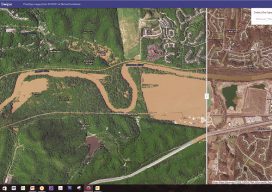
The 2017 Flooding of Missouri’s Meramec River
Missouri’s Meramec River is one of the largest free-flowing waterways in the state. With a source southwest of St. Louis, in Dent County, and the mouth at the Mississippi River in Arnold, some 20 miles south of St. Louis, its meandering 220 miles drain nearly 4,000 square miles in a watershed covering six Missouri counties....
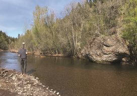
Assessing the Potential
UAS-based Topobathymetric Lidar Surveys Understanding stream channel and floodplain morphology is critical for a number of efforts—from hydraulic modeling and stream-restoration design to aquatic habitat assessment. These applications require description of conditions both inside the channels and in the adjacent riparian zones. Gathering these data has typically relied on individuals on the ground or in...
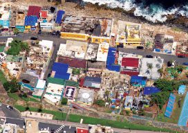
Aerial Imagery to the Rescue
Events in 2017 demonstrated without any doubts or reservations how vitally important georeferenced aerial imagery is in assessing damage and supporting relief efforts following a natural calamity. Last September, an impromptu consortium of companies in North America mobilized their forces and collected and analyzed mountains of data at near cost to help out in what...