Category Archives: Enviro/Ag
Sid Nair
Sid Nair – Senior Director, Marketing and Product Management, Teletrac-Navman – California, USA There’s a lot of talk about “the internet of things,” or IoT, but of great and lasting value is “the internet of where things are”—how better to manage assets and processes spatially. There are all sorts of ideas of how to make...
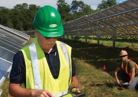
Maximizing the Sun
Solar energy grows in part due to aerial imaging and surveying. Solar power is booming in the United States. “Every three weeks,” President Obama said in his 2015 State of the Union address, “we bring online as much solar power as we did in all of 2008.” Geospatial technologies—especially remote sensing and surveying—play an important...

Surrogate UAS
Above: Hart Drobish, president of Courtney Aviation, was a contractor to the forest service flying the air tactical control platforms on the Happy Camp Complex wildfire. Additionally, Drobish served as a ground liaison contact on the project, managing the flow of infrared and visual imagery from the aircraft to the end users. Combining UAV technology...
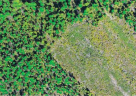
Lidar for Forestry
Above: Lidar-derived tree crowns and maximum tree-top heights are overlaid on a 20cm orthophoto. Vector-based products allow for a transition from the point cloud to GIS. A forester’s guide to understanding lidar topics, from upfront data-acquisition costs to business benefits to the path from research to operationalization. Although many lidar industry insiders never imagined the...
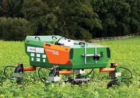
Unmanned Systems
Above: This robot, the BoniRob, was developed for precision agriculture by Osnabrueck University of Applied Sciences in Germany, led by Arno Ruckelshausen. Robots for Precision Agriculture, Weather Forecasting, Scientific Studies From Amazon to Google to Domino’s Pizza, unmanned aircraft systems (UAS) have been drawing significant attention in recent months. Amazon plans to launch a Prime...
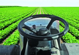
Satellite Signals Steer Farmers Straight
Precision agriculture combines GPS, remote sensing, and GIS to capture large amounts of georeferenced data on spatial variations in soil types, moisture content, nutrient availability, and crop yields and then create and follow prescription maps. Until recently, it was difficult for growers to correlate soil and crop information with production techniques, so they generally treated...