
Category Archives: Press Releases

xyHt News Links: 4/1/16
East View Now Offering PlanetDEM 30 Plus Trimble Seismic Navigation Systems Support Stakeless Operations for Geophysical Exploration Boundless Launches Complete Open Source GIS Platform for the Enterprise Driverless Conference sparks autonomous car development analysis FARO® Introduces World’s First 3D Scan Localizer and the First FARO Innovation Product Introduction in FARO’s new Early Adopter (EA) Program...
xyHt News Links: 3/25/16
Hemisphere GNSS debuts smart antenna for survey New Online Mapping Platform, Azimap, Launched NCEES launches national surveying education award
xyHt News Links: 3/18/16
ZEB‐REVO – A Revolution in Mobile Indoor Mapping SPAR 3D Expo & Conference announce live demonstrations and special events. Asset Owners Share Business Drivers for 3D Technologies at SPAR 3D Kongsberg reference system integrates GNSS services Cadcorp announces new enterprise GIS software licensing model Hemisphere GNSS Debuts S321 GNSS Survey Smart Antenna Maryland’s MD iMAP...
xyHt News Links: 3/11/16
Trimble 4D Control Software Supports IBIS-FM Radar Device for Slope Stability and Structural Monitoring in Mining TerraGo Launches On-Demand Solution for Mobile Forms, Inspections and Surveys Topcon announces new geodetic antenna Maptek modelling and exploration technology on show at PDAC Teledyne Optech Press Release: Innovative solutions for bathymetry at Oceanology International 2016 3DR collaborates with...
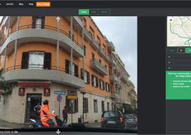
An interview with Mapillary CEO Jan Erik
Following Mapillary’s announcement yesterday, I sought to get more information about Mapillary and how they have come to be such an interesting prospect in the geospatial world. Mapillary is a pioneer in new ways to capture, share, and utilize street-level images. Yesterday I had the privilege to interview Jan Erik Solem of Mapillary to get the...
Mapillary Raises $8 Million Series A to Democratize Maps by Connecting the World’s Photos
Technology has made the farthest corners of the planet more accessible than ever before. We can video call loved ones on the other side of the world; and we can view photos of foreign landmarks at the click of a button. At Mapillary, we are taking this accessibility to the next level by letting anyone...