
For more than two decades, the geospatial and construction technology markets have advanced by adding capability. Each generation of GNSS receivers, robotic total stations, scanners, and machine control systems has delivered real gains in accuracy, speed, and automation. But those gains have often come with a parallel cost that is harder to quantify: complexity.
Licensing models multiplied. Feature sets fractured into tiers. Proprietary ecosystems narrowed options. Lead times stretched. Support moved further from the field. What began as innovation gradually introduced friction—often invisible at purchase, but unavoidable in daily use.
Today, the question facing surveyors, contractors, and dealers is no longer whether technology can do the job. It is whether that technology can be deployed quickly, integrated cleanly, supported reliably, and justified economically over time. The cost of ownership is measured less in hardware price than in time to productivity, clarity of workflows, predictability of pricing, and access to real support when systems fail under pressure.
This shift is visible across the industry. Survey firms are expanding services with smaller teams. Contractors are pulling geospatial data deeper into construction workflows. Dealers are expected to support broader solution stacks without adding staff. In that environment, even technically strong products struggle if they add friction at the wrong points.
Stonex entered this moment by asking a different question. Rather than chasing incremental performance, the company focused on where complexity had begun to work against adoption.
“Most of the pain in this industry isn’t about accuracy anymore,” says Ray Weatherbee of Stonex USA. “Accuracy is largely solved. The pain is friction—how long it takes to get productive, how hard it is to integrate, and how much cost shows up after the sale that nobody talked about.”
That perspective—friction-first rather than product-first—has shaped Stonex’s portfolio, pricing, and dealer strategy.
A Portfolio Shaped by Real Workflows
Stonex’s product range spans GNSS receivers, robotic total stations, scanning systems, GIS and mobile GNSS devices, UAV payloads, and machine control. At a glance, that breadth could suggest sprawl. In practice, it reflects how work actually flows across surveying, mapping, and construction.
Surveyors establishing control, crews collecting topographic data, and contractors executing grade increasingly rely on the same positioning infrastructure. Data captured early in a project now moves downstream with fewer handoffs. The boundary between “survey gear” and “construction technology” continues to erode.
Stonex has leaned into that reality. Rather than organizing products around rigid categories, the company aligns them around workflow continuity. GNSS base and rover systems often serve as the entry point. Total stations extend precision where satellite visibility degrades. Scanning systems add context and density. GIS and mobile GNSS tools support asset capture and verification. Each layer builds on the last.
“Customers don’t think in categories,” Weatherbee says. “They think in terms of getting work done. If survey, scanning, and construction all live on different islands, the technology becomes the problem instead of the solution.”
This philosophy shows up clearly in Stonex’s optical and robotic total station lineup. Designed to support boundary surveys, control networks, and construction layout, these instruments emphasize reliability and ease of deployment over specialization. For firms that move between survey and construction work, that versatility reduces the need to maintain parallel systems.
The same logic applies to Stonex GNSS receivers, which are designed to operate across surveying, construction, and mapping workflows without forcing users into narrow use cases. Dealers can position them as flexible tools rather than entry-level or niche devices.
Lowering the Barrier Without Lowering Expectations
Scanning provides one of the clearest examples of Stonex’s simplification strategy in action. Once dominated by six-figure systems and specialized operators, scanning has entered a new phase. Advances in SLAM algorithms, processing software, and data extraction tools have reduced technical barriers. What remained was economic friction.
Stonex’s 3D scanning portfolio—covering handheld, mobile, and application-specific systems—targets that gap directly. With scanners typically priced between roughly $10,000 and $30,000, the company has aligned performance with the practical needs of surveyors, engineers, and contractors who want scanning to augment their services rather than redefine their business.
“The technology matured,” Weatherbee explains. “What held people back wasn’t whether the data was good enough. It was whether they could afford it, deploy it, and actually use it without becoming scanning specialists.”
That same approach carries through Stonex’s SLAM laser scanners. Designed for speed and usability, these systems allow users to capture complex environments without extensive setup or control networks. For many firms, SLAM scanning now fills the gap between traditional surveying and full terrestrial laser scanning.
UAV payload scanners extend that capability into aerial workflows. By offering payloads that integrate cleanly with existing GNSS and processing tools, Stonex enables firms to expand into aerial scanning without rebuilding their software stack.
The result is not lower standards, but more accessible ones. Firms that once outsourced point cloud work now bring it in-house. Dealers can introduce scanning incrementally. Return on investment arrives faster because scanning becomes a workflow extension rather than a separate discipline.
Ease of Use as a Strategic Choice
Ease of use is often framed as a user interface problem. At Stonex, it is treated as a business strategy.
Setup time, calibration effort, and learning curves directly affect adoption. Systems that take weeks to master delay productivity and erode trust. Stonex has focused on shortening the path from unboxing to execution across its portfolio.
Hardware configuration is simplified. Calibration routines are reduced. Interfaces prioritize clarity over customization. That philosophy carries into software, particularly with Cube 3D and related Cube applications, which are designed to support field-to-office workflows without forcing users into proprietary logic.
“If it takes weeks to get comfortable, people stop trusting it,” Weatherbee says. “Ease of use isn’t about dumbing anything down. It’s about removing steps that don’t add value.”
This matters because users are not interchangeable. A surveyor, a GIS technician, and a machine operator interact with data differently. Stonex products are designed to support competence across roles without demanding uniform expertise.
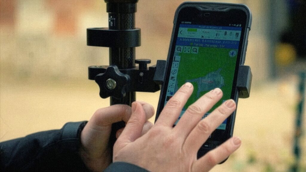
GIS and mobile GNSS devices reflect this focus clearly. Built for asset collection, verification, and field updates, these tools emphasize reliability and straightforward operation. They are intended to work alongside higher-precision instruments, not compete with them.
Interoperability as a Baseline Assumption
As survey, mapping, and construction workflows converge, interoperability has shifted from a differentiator to a baseline expectation. Survey data feeds BIM environments. Construction progress updates GIS systems. Machine control relies on GNSS networks that may not belong to a single vendor.
Stonex treats this reality as foundational. Products are designed to integrate into mixed-brand environments. Data formats remain open. Software workflows accommodate third-party tools rather than replace them.
“Forcing exclusivity creates friction for everyone,” Weatherbee says. “Dealers know their customers. Contractors know their workflows. Our job is to fit into that reality, not fight it.”
This stance is particularly important for dealers. Roughly 90 percent of Stonex dealers represent multiple brands. They sell solutions, not silos. By avoiding artificial barriers, Stonex reduces integration risk and preserves flexibility.
Customers retain choice. Dealers retain credibility. And workflows remain intact as projects move from survey to scanning to construction.