Tag Archives: BIM

Building Information Modeling
How cloud integration can unleash its full potential In the building and construction industry, Building Information Modeling (BIM) has revolutionized the way professionals conceive, construct, and manage our built environment. Since its introduction in the 1970s, BIM has evolved from rudimentary 2D digital representations to becoming the backbone of modern construction projects. Today, its significance...

BIM: Into the Future
Looking Forward The concept of building information modeling has existed since the 1970s, although we certainly didn’t recognize it then. That’s when the first software tools developed for modeling buildings started to emerge. Those early applications and the computers needed to run them were expensive, so adoption wasn’t widespread. BIM gradually evolved, though still far...

xyHt Weekly News Recap: 04/14/2023
INTERGEO 2023 – BIM in Construction NV5 Completes the Acquisition of L3Harris Subscription-Based Geospatial Software Business Hexagon Releases First Autonomous Construction Tech Outlook Qualcomm and Xiaomi Demonstrate Mobile Meter-Level Positioning Capabilities Worldwide UP42 and Vexcel Expand Aerial Imagery and Geospatial Data Portfolio AEM Hall of Fame Invites Nominations for 2023 Class Fugro Supports Development of...

New In-field Efficiencies Raise the Roof in the French Alps
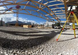
Refining and simplifying typical desktop workflows helps French surveyors realize efficiencies in major exhibition center renovation Nestled in the heart of the French Alps, close to the world-famous Mont Blanc and picturesque lakeside city of Annecy, lies the Rochexpo, the Haute Savoie Exhibition Centre. Host to more than 50 events during the year, including the...

Sounds Good
Using powerful simulation algorithms, this young and award-winning acoustics software startup from Iceland is making sound visible. No wonder it’s already creating a buzz in the BIM community. For Finnur Pind and Jesper Pedersen, success started inside a dark and windowless basement. Backed by a research grant in 2020 and a free room down in...

Repositioning GIS
The technology that will drive the next era Esri calls GIS the nervous system of the planet, a platform relevant to almost every human endeavor. It’s a way to display, manipulate, and analyze geospatial data—and that ability is ever changing and expanding across industries. GIS technology allows us to derive location intelligence from spatial and...
