The technology that will drive the next era
Esri calls GIS the nervous system of the planet, a platform relevant to almost every human endeavor. It’s a way to display, manipulate, and analyze geospatial data—and that ability is ever changing and expanding across industries.
GIS technology allows us to derive location intelligence from spatial and non-spatial data. Beginning at a local scale (e.g., managing day-to-day operations on a project work site), to regional (e.g., mapping and managing the infrastructure of a city or district), and all the way to national and global-sized problems (e.g., tackling pandemics, mitigating the effects of climate change), GIS is helping today’s workforce make better, faster, safer, and more environmentally sustainable decisions.
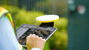
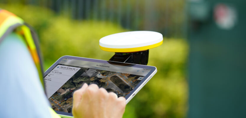
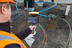
The Bluetooth®-enabled Trimble DA2 GNSS receiver for the Trimble Catalyst positioning service, shown here with the handle accessory, greatly increases the range of devices, workflows and apps for mapping and GIS data collection projects.
According to market research firm IMARC Group’s report “Geographic Information System (GIS) Market: Industry Trends, Share, Size, Growth, Opportunity, and Forecast 2022-2027,” the global geographic information system (GIS) market was $10.1 billion in 2021. Moving forward, the study forecasts double-digit growth to $21.1 billion by 2027.
Here are four areas of advancement that will help drive this growth and shape the future of GIS.
3D Foundation: The future of GIS is rooted in 3D, specifically the growing interdependence between GIS and intelligent 3D models or building information models (BIM). BIM is making GIS easier to consume, and easier to understand, enabling the increasing use of geospatial data and geo-enablement of businesses and industries by making geospatial data more accessible.
In the context of 3D, BIM is often the first thing that comes to mind for many—with good reason. At its simplest level, a building information model is a 3D digital representation of the physical and functional characteristics of an asset, such as a building or bridge. It’s a great resource for document management, project coordination and collaboration, and even simulation.
While BIM and 3D CAD can give us a view of a building during design and construction, these same intelligent models with a geospatial GIS component can help locate assets, route resources, and plan scenarios. In essence, GIS provides information about assets in the context of the natural and built environments. It’s a way to see and study spatial relationships.
For example, an electric utility can use 3D GIS to see where tree growth is endangering power lines, and city water departments can get a more complete view of the infrastructure underground to plan repairs more accurately with the necessary equipment and safety considerations.
In a bigger-picture example, Esri’s CityEngine software, which includes BIM connections, allows the production of urban scenes based on real-time, 3D GIS data, so users can plan city architecture, design, and community development. It’s imperative that the industry works toward more seamless GIS/BIM connections.
Now add in direct connections to the real world and GIS becomes the foundation to transform the virtual world.
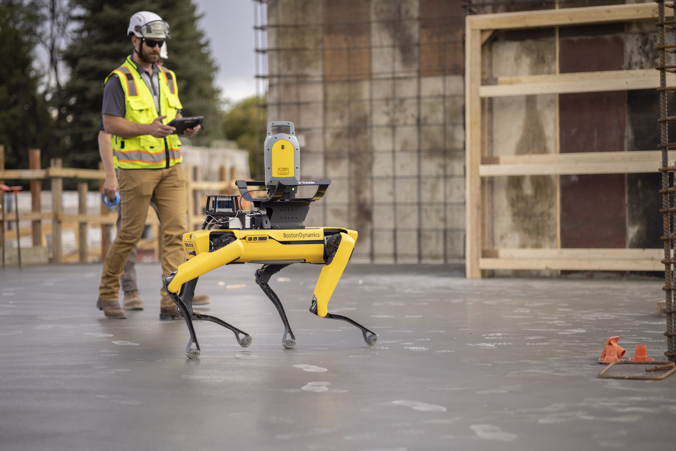
Robotics and autonomous solutions, such as Spot the robotic dog are on the cusp of explosive growth, and some will be designed specifically for mapping and monitoring.
AI, ML and IoT: Much of the anticipated growth of GIS will be tied to the evolution of cloud computing and artificial intelligence (AI) as well as geospatial capabilities such as location-based data services and geo-analytics. As Esri President Jack Dangermond stated not long ago, “The geospatial industry is quickly evolving because the capabilities of digital connectedness and collaboration are moving ahead exponentially.” He further pointed to the importance of “making data more accessible and creating context to visualize this data in an age when fast, easy access to information is taken for granted.”
With the explosion of smart sensors, connected cities, and systems that enable mass capture of geospatial data, there is a proliferation of availability of spatial data to which AI and machine learning can be applied. While machine learning is not a new concept, the use of this technology in ways that specifically incorporate geographic and spatial concepts directly in the processing and computation will grow exponentially over the next decade and become mainstream.
Spatial machine learning will be used in three primary ways: to predict outcomes, classify object types and attributes in mass datasets, and group data based on similarities in value or location.
Automation and Robotics: The industry is on the cusp of an explosion of advancements in the use of robotics and autonomous solutions. Some of these robots will be dedicated systems designed specifically for conducting mapping and monitoring activities. Others will be autonomous vehicles that are used for other purposes but will leverage the navigation data to build an ever-updating representation of the world.
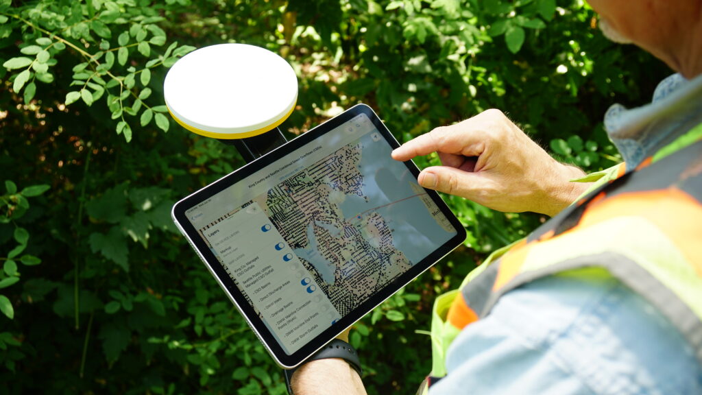
Cost-effective positioning is available for any industry by turning a smartphone or tablet into a precision mapping, navigation, and measurement tool with Trimble Catalyst, a GNSS concept delivering positioning-as-a-service to Android and iOS devices.
In agriculture, the combination of GIS, GNSS, and robotics technologies are automating field operations. From autonomous building sites and bridge inspections to remote rural mapping projects, autonomous robotic technology is enabling work to be done faster, safer, and more cost effectively than ever before—and GIS is an integral part of these solutions.
Indoor Mapping: According to the Environmental Protection Agency, Americans on average spend 90 percent of their time indoors.
GIS is a key driver of both the adoption and integration of indoor positioning technology. The convergence of indoor positioning technology, ubiquitous connectivity, as well as advances in 3D visualization and manipulation technologies (such as augmented reality and mixed reality) have enabled great leaps in the utility and usability of indoor mapping and GIS technology.
With the rapid evolution of indoor mapping technology, combined with the clear utility of this technology, the adoption of indoor mapping is realized in more and more verticals every day.
In the future, the boundaries between indoor and outdoor mapping will become even more blurred. Adoption and integration of real-time digital representations of the physical world will make indoor mapping-based workflows (such as asset tracking, navigation, emergency response, and planning) even more immersive and productive.
At Trimble, we are hard at work thinking about the intersection of all of these areas. We’re intent on leading the way by embracing innovation in all its forms—from applying existing technology in surprising new ways to opening untapped frontiers.
Advances in 3D visualization and manipulation technologies enable users to visualize existing infrastructure, design plans and future structures, and spot and solve issues early.
Key to our approach is the delivery of purpose-built solutions that integrate complex, real-time data throughout full- project lifecycles, providing a seamless system workflow where innovation meets action, software meets hardware, office meets field. The result: we are helping customers around the globe to optimize operations across a wide range of industry end-markets.
I am inspired by the possibilities unlocked by GIS technology and its role in improving business, industries, and all of humanity. GIS technology overwhelmingly has positive impacts on the way organizations, industries, institutions, and even nations conduct themselves.
GIS helps drive intelligent decision-making—decisions that affect the safety, security, and sustainability of our world. GIS also helps us build and gather knowledge and share that information equitably in understandable ways. Those principles haven’t really changed a whole lot over time. Perhaps where we do see change is the ways that information is collected, collated, analyzed, and shared.
The huge technical drivers of connectivity and the exponential increase in the amount of data that is being captured and processed, and the continued evolution of the technical sophistication of the tools we use to crunch that data are all contributing to GIS data and analysis becoming more and more sophisticated.