Tag Archives: faa
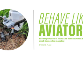
Behave Like Aviators
The importance of rules and conduct when flying small drones for mapping
Safety is Paramount in Aerial Drone Mapping
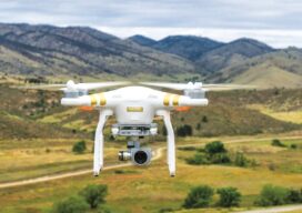
As the Federal Aviation Administration (FAA) prepares to release its ruling covering uncrewed aircraft flights beyond visual line of sight (BVLOS) in the National Airspace (NAS) the entire industry is holding its breath preparing for a new era of certainty and expansion. Aerial photogrammetry will be one of the immediate beneficiaries of this new policy...

xyHt Weekly News Recap: 11/04/22
RIEGL announces NEW VZ-600i Hexagon to Update Aerial Data of Eight U.S. States at Six-Inch Resolution in 2023 Bracell Wins EU Esri 2022 Award with Geoprocessing Project SuperMap Showcased GIS Technologies and Solutions at INTERGEO 2022 Topcon Invests in the Future of Construction with Donation to TU Dublin VOTIX Software Allows AviSight to Achieve BVLOS...
xyHt Weekly News Recap: 10/21/2022
Teledyne Announces Ladybug6 Cameras for High Accuracy 360-Degree Spherical Image Capture Hexagon and LocLab Work to Accelerate Adoption of Smart Digital Realities Vexcel Imaging Introduces UltraCam Eagle 4.1 Photogrammetric Aerial Camera System Phase One to Launch New Calibration Center at Denver Headquarters Soaring Eagle Technologies Receives Long Distance FAA Waiver for UAS Inspections Common Ground Alliance...
UAS and ALTA Surveys – Part Two
Surveying firms that have been successful in incorporating UAS data in ALTA surveys adopt best practices to ensure precision standards are met. Plan, execute, and check. In Part One of this three-part series in the September xyHt issue, we looked at the time/cost/precision proposition of using UAS for elements of ALTA surveys. Firms interviewed agreed...

The Wide World of Drone Upstarts
With congested airspace in the U.S. and Europe, to see how drones will integrate with society we have to look at some creative drone upstarts emerging in less populated nations. In our last article we touched on the ramifications of a clear regulation of uncrewed flights beyond visual line of sight (BVLOS) in the USA and...