Tag Archives: geopipe
Automated City Extraction
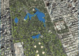
Above: A portion of New York’s Central Park and surrounding neighborhoods, as automatically parsed into GIS data and reconstructed into 3D models by Geopipe. A new company called Geopipe builds 3D models using machine learning and AI, but with no photogrammetrists? A couple of weeks ago I found myself on a video call with a...