Tag Archives: Trimble

xyHt Weekly News Links: 07/30/2021
Trimble Boosts Flagship RTX Correction Services Performance Common Ground Alliance Releases Newest Edition of Best Practices Guide North Dakota DOT Selects GeoCue for UAS Program Esri to Expand Geospatial Innovation in St. Louis Area Commercial UAV Expo Exhibit Floor Nearly Sold Out dSPACE and Cepton Partner to Provide 3D Lidar Simulation infiniDome Debuts Anti Jamming...

xyHt Weekly News Recap: 07/02/2021
Septentrio Announces Partnership with XenomatiX Anguilla Launches New Land Information System from Trimble TomTom’s Advanced Mapping Technology Powers the Nissan Qashqai Volatus Aerospace and ConnexiCore Create Largest Drone Service Provider in North America Inhofe Introduces Bill to make Ligado Pay Everyone Harmed Velazquez Reintroduces Bill Establishing National Database to Combat Rising Sea Levels AB Surveying...

xyHt Weekly News Recap: 06/25/2021
Teledyne Optech makes First Delivery of CZMIL SuperNova Robotic-based Solutions Enhances Curb and Gutter Paving Performance Bentley Acquires 3D Modeling Software Company Seequent Keynote Lineup Announced for Commercial UAV Expo Americas 2021 Trimble and Infotech to Streamline Inspection Workflows for Infrastructure Projects J. Dan Bremser Named President of Massachusetts Surveyors Organization Geo Week has Massive...

xyHt Weekly News Recap: 05/21/2021
Teledyne Completes Acquisition of FLIR Trimble Introduces VRS Now Correction Services to Norway EOfactory.ai Scales Up Capabilities with CATALYST Microservices Skyward Introduces Mapping and Modeling powered by Pix4D Next GEOINT Service Day Series is June 9 Woolpert, Planet Partner to Deliver Imagery Worldwide Jack Dangermond Honored by IGU with Planet and Humanity Medal Bluesky 5cm...

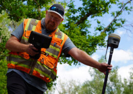
GNSS rover developments give surveyors a new edge
Chris Trevillian describes the Trimble R12i GNSS receiver with ProPoint engine with tilt compensation and calibration-free operation for flexibility, traceability and robustness

xyHt Weekly News Recap: 02/19/2021
GNSS Receiver Keeps Around-the-World Yacht Race Winner in Position USGIF Accredits University of North Georgia New Trimble Total Stations Adds Versatility The Next Generation of Drone LiDAR MAPPS Awards Michael Baker International’s for Excellence NOAA Picks Woolpert to Collect Topo-Bathy Imagery NV5 Geospatial Unveils Cloud-based Data Management Platform
