

Esri’s distinguished product manager for geospatial AI has been shipping AI inside ArcGIS since the ArcMap era. A conversation after this year’s User Conference covers the real difference between an AI assistant and an agent, why Esri built its own governance board around the distinction, and what MCP actually solves for a profession that can’t afford a plausible-sounding wrong answer.
Assistant, Tool, or Agent
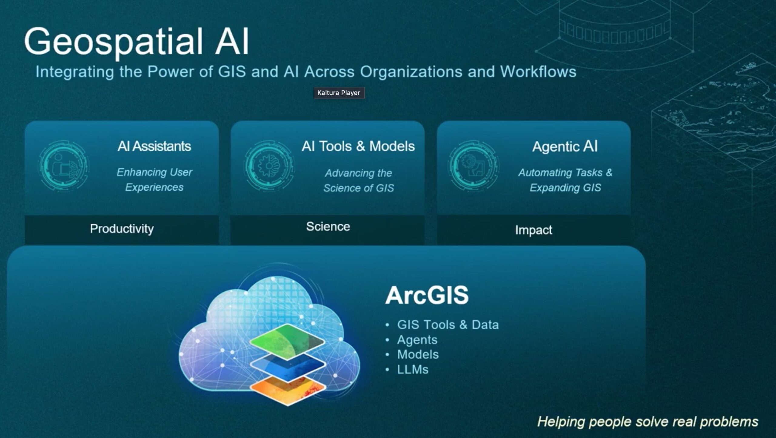
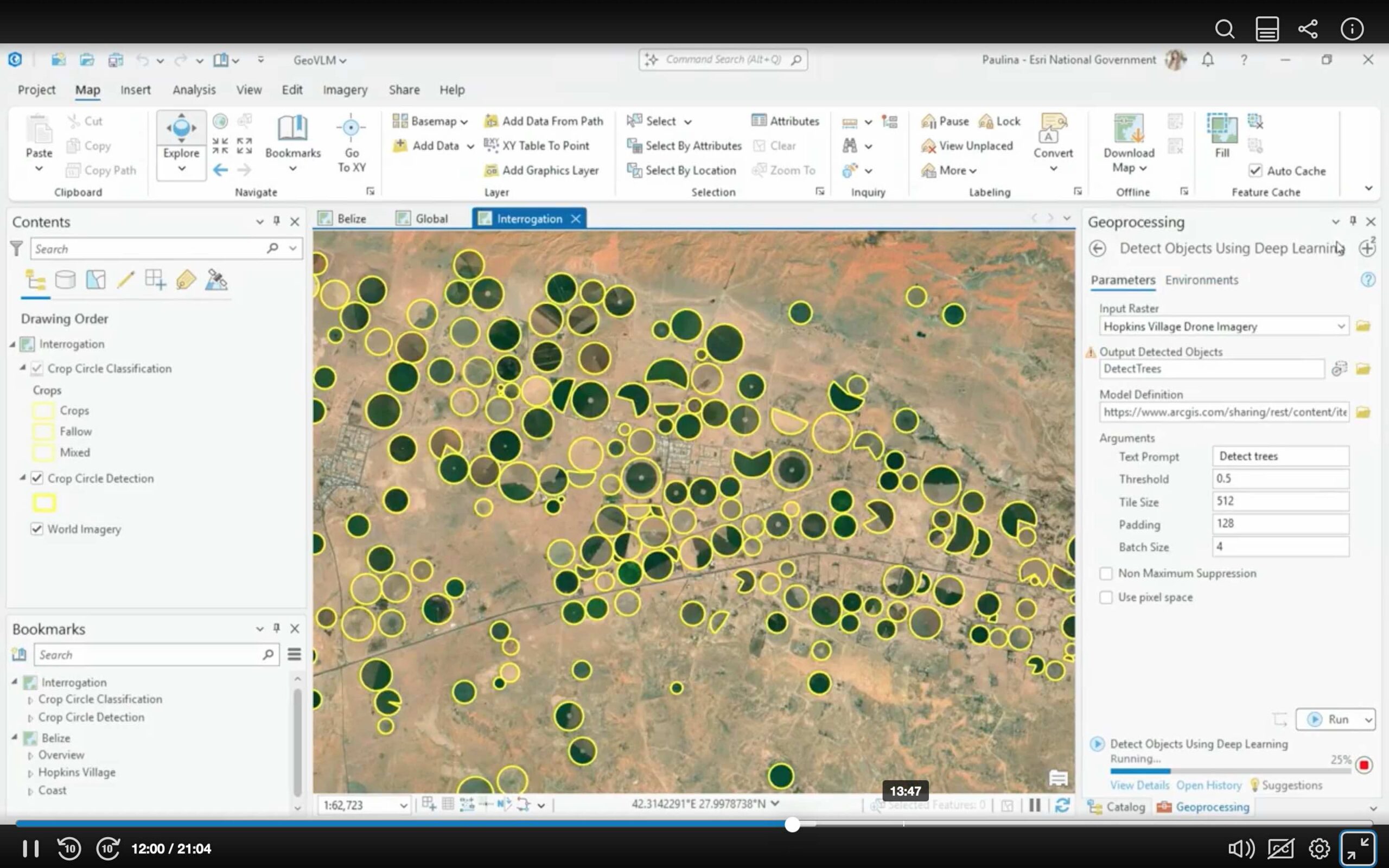
Ismael Chivite, Esri’s distinguished product manager for geospatial AI, opened by drawing a line between two things the industry tends to lump together under the same word. “There are three fundamental areas,” Chivite said. “The first one relates to enhancing the user experience of GIS products that often are very sophisticated. That’s the context of AI assistants. An AI assistant is really an enhancement to the user experience of a product that makes it easier to use.” The second area, AI tools and models, covers the deep-learning capabilities Esri has shipped for years — feature extraction, pattern recognition, classification of imagery, lidar, and text. Agentic AI, the third area, is a different kind of thing entirely. “This is not about assisting people,” Chivite said. “It’s really about automating workflows and creating totally new user experiences for the non-technical user that wants to access the geospatial information we create.”
Geospatial AI itself, Chivite was careful to point out, is not a new initiative at Esri dressed up in current terminology. “We shipped the first tool with artificial intelligence built in back in the ArcMap days,” he said, referring to Esri’s now-retired flagship desktop GIS product. “Geospatial AI is definitely not new.” What’s new is the assistant and agentic layers building on top of that older foundation, and the pace at which Esri is now shipping them: three AI assistants released in June 2026, with roughly a dozen more planned across different ArcGIS platforms between now and the end of 2027.
What MCP Actually Fixes
Asked to explain why the Model Context Protocol has become a fixture of conversation at this year’s conference, Chivite framed it as an interoperability standard solving a specific, geospatial-flavored version of a much bigger problem. “Organizations, aside from the work that we do with geospatial, are already experimenting with and looking at implementing agents and agentic AI in business workflows,” he said. “This is both a big opportunity and a big risk.” The risk, specifically, is that most general-purpose agentic platforms have no geographic awareness built in. “There are many agentic platforms out there that do amazing things, but they are not geospatially intelligent,” Chivite said. “I think there is a big business risk of organizations adopting agentic AI with technology that really doesn’t take into consideration geography.” MCP, in Chivite’s framing, is one of several approaches to that problem, but a significant one — a standard that lets an AI agent reach into geospatial tools and data directly, so that geography factors into the agent’s reasoning rather than getting bolted on after the fact. ArcGIS Enterprise is set to incorporate MCP natively in November 2026, with ArcGIS Online following in early 2027.
Two Products, Deliberately Different Audiences
Chivite pointed to two specific products under active development as concrete examples of where the assistant and agentic categories diverge in practice. Agentic mapping apps let a GIS user turn an existing web map into a conversational experience — a chat interface non-technical users can query with filtering and contextual questions — authored without writing code. Those are in beta now, with general release planned for 2027. Agent Builder, a separate and newer product, lets a GIS professional visually construct geospatial agents that can either power an organization’s own agentic mapping apps or be exposed to third-party, general-purpose agentic platforms elsewhere in a customer’s business.
Chivite was direct that the two layers are built for different users on purpose, not by accident of engineering. “The use of agentic AI and generative AI has big opportunities and big risks,” he said. “If you think about the assistants, it’s work that is definitely targeting the GIS professional and nobody else. When you are using assistants, it is understood that you already know the fundamentals of GIS and geographic science. Without that type of knowledge, these assistants are actually not designed for the non-technical user.” Agentic AI inverts that audience deliberately, aiming to open geographic analysis to people with no GIS background at all — which is precisely why Chivite said the agentic layer is built with narrower, more constrained capabilities than the assistant layer. “The types of things that these agents will do will be limited, and they will be limited by design, on purpose, to avoid people from making the wrong calls.”
Governance, in Detail
Esri’s public framing of AI governance, published on the company’s ArcGIS Trust Center, breaks its use of artificial intelligence into the same three categories Chivite described in the interview: AI tools and models, AI assistants, and agentic AI. The governance structure sitting over all three rests on six stated principles — security, privacy, transparency, fairness, reliability, and accountability. In practice, Esri describes that framework as opt-in by default: generative AI features are not enabled automatically in ArcGIS products, and administrators or end users have to turn them on. Data handling follows the same logic. Unless a customer explicitly authorizes it, such as by submitting feedback inside the application, prompts and data used with AI assistants are not used to train Esri’s models and are not shared. Where Esri relies on third-party AI services, the company says it segments customer data through enterprise-class AI instances rather than pooling it.
The governance work is dated specifically to 2023, when Esri formed an AI Governance Board — the body Chivite described meeting weekly to review every proposed AI feature before it ships. “Every time an Esri development team considers the use of AI, they go through a very strict review process with the AI advisory group,” Chivite said, “to review what AI is going to be used for, what type of AI is going to be used, how it’s going to be exposed to the users, and how the product adheres to the privacy and security guidelines of the company. It’s a level of scrutiny we never actually put in software development teams before. We always had QA reviews and internationalization reviews, but when it comes to AI, we step up quite a bit.”
The most granular documentation Esri publishes is a set of AI transparency cards, rolled out progressively as individual AI assistants move through beta. Each card is meant to answer the same fixed set of questions for a given feature: what the feature does, how it works, what data it draws on, what safeguards are in place, and what certification or compliance status applies. Esri frames the cards as a complement to industry-standard AI model cards, which document a model’s architecture and training data but not how a specific vendor has integrated it into a specific product. Chivite pointed to the governance materials as public information rather than internal policy — “all our guidelines for AI are actually publicly available at trust.arcgis.com, so anyone can look at the principles and the guardrails that we apply to our software development process.” Esri’s own materials are candid about a limitation that no amount of governance process removes: generative AI carries an inherent potential for inconsistent output, and the company’s stated position is that a human should always be in the loop to assess whether that output is appropriate before it’s used.
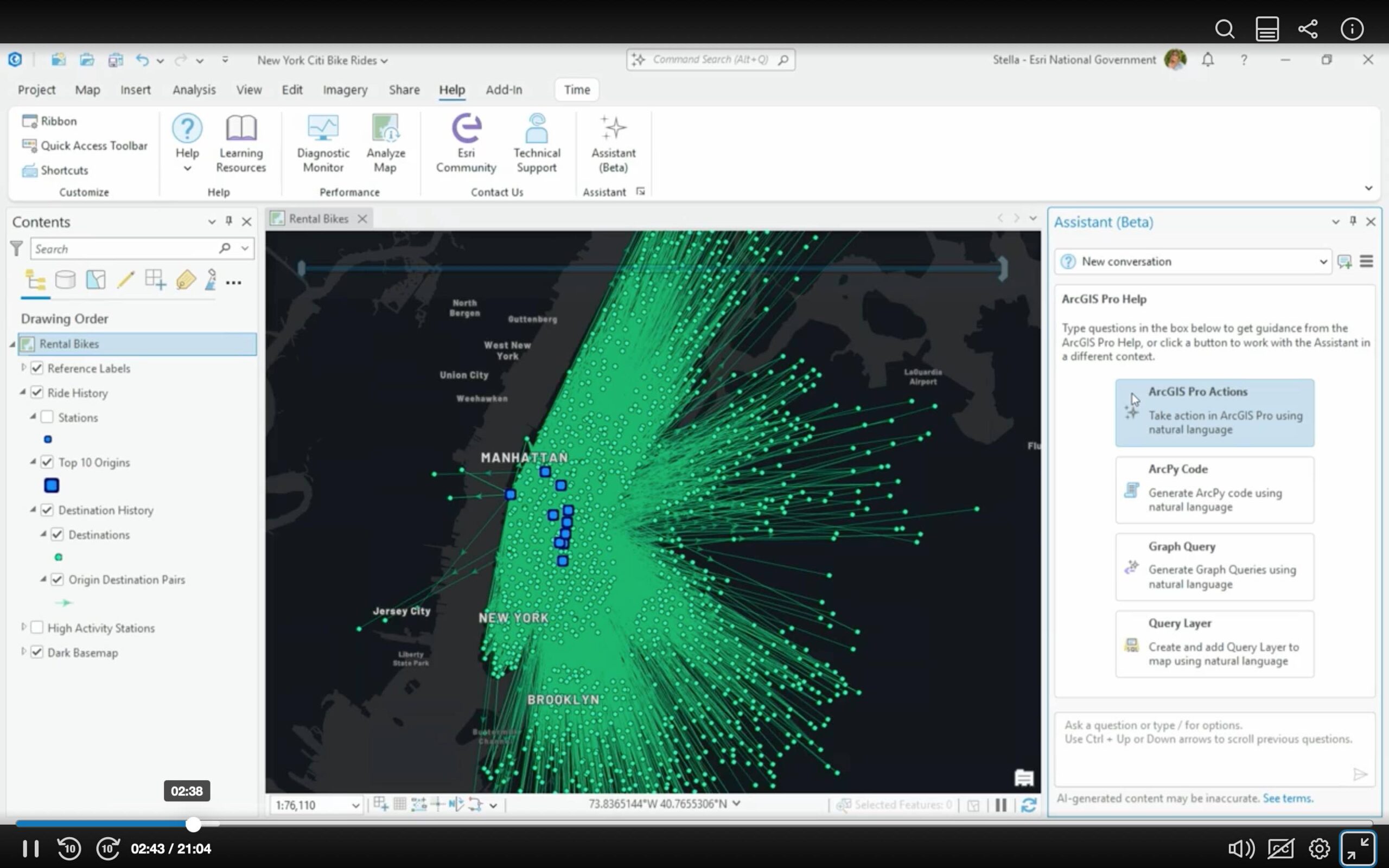
Esri’s published materials draw a specific boundary around what an assistant is allowed to do on its own. The company describes its AI assistants as providing coding support, workflow guidance, and in-context answers using natural language, explicitly without taking action on the user’s behalf or making autonomous calls where human judgment belongs. That same caution shows up in Esri’s release cadence: AI capabilities in ArcGIS spend a considerable amount of time in beta before reaching general availability, and Esri describes that delay as intentional rather than a bottleneck. The same logic extends to how Esri frames MCP for enterprise customers specifically — the goal, in the company’s words, is that an organization should not have to choose between the AI platform it has already committed to and geospatial capability, with MCP serving to connect geographic context directly into whatever agentic AI ecosystem an enterprise is already running, so that AI-driven decisions stay grounded in authoritative geographic data rather than floating free from the places and communities they affect.
What Adopting This Actually Costs
Asked whether an organization already running ArcGIS needs new infrastructure or licensing to adopt any of this, Chivite’s answer split cleanly along the same three-category line. AI assistants carry no additional license cost and require no new infrastructure — they run on AI services Esri already hosts in ArcGIS Online, with one exception: an ArcGIS Enterprise customer that wants to run its own large language models locally, for security or other reasons, has to build that infrastructure itself. AI tools and models are different: some require the higher Professional or Professional Plus user-type tiers, and many require the customer’s own GPU-capable hardware, whether a desktop workstation or a laptop, to run. Agentic AI is the least settled of the three. “The licensing is actually not finalized yet,” Chivite said. “I can anticipate that agentic AI will require an additional level of licensing for you to take advantage of these agent builders, agentic mapping apps, and co-work experiences.”
Filtering the Noise
Closing the conversation, Chivite pushed back gently on the idea that the geospatial industry needs to catch up to the broader AI conversation happening elsewhere.“When it comes to really using technology that solves real problems, I think our industry — geomatics and geospatial communities — are actually doing really well, eliminating the noise from the general purpose AI discussions out there that sometimes are really totally out of touch, and really applying the technology to things that make a difference for people.” That framing tracks with the caution built into Esri’s own AI governance process: not a reluctance to ship AI, but an insistence that geospatial AI answer to a narrower, more accountable standard than the general-purpose products setting the pace of the wider conversation.