Category Archives: Space
Sponsored Content: Revolutionizing Utility Mapping in North America
As many of you already know, inaccurate utility locational data is one of the main causes of utility strikes. In 2021, this has led to an estimated $30 billion societal cost due to delays and damages in the USA alone, according to The 2021 Damage Information Reporting Tool (DIRT) Report released in October by the...
Space Mapping
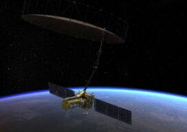
A satellite set to launch in 2024 will scan the Earth’s surface every 12 days. What does that mean for geospatial professionals? During the recent South Florida GIS Summit, I had the pleasure of attending a presentation by the National Aeronautics and Space Administration (NASA) that blew my mind in terms of potential for the...

xyHt Digital Magazine: December 2022
xyHt’s December issue tackles a hodgepodge of subjects, from the what’s going on in the ocean to satellites mapping from space. As always, if you don’t have a subscription to our print edition, or if someone else in the office has snaffled your copy, don’t fret, here is the digital edition. Click here or on the cover...

Farming From Space
Airbus and Sentinel Fertigation use satellite imagery to improve sustainable crop production With help from Airbus’ detailed high-resolution 30cm satellite imagery provided by Pléiades Neo, a Midwest crop management software platform is offering a streamlined process for farmers fertilizing crops via irrigation (known as fertigation). Using multispectral imagery of field conditions, Lincoln, Nebraska-based Sentinel Fertigation...

Sponsored Content – OneAtlas: Processing Satellite Imagery in the Cloud
Airbus Intelligence provides users with access to satellite imagery, innovative geospatial analytics, and industry-specific insights. Image data from the Airbus Constellation of satellites, which includes twin SPOT 6/7, Vision-1, Pléiades, and Pléiades Neo satellites are used to deliver actionable intelligence to a variety of markets around the globe. Already known for quick processing and delivery...

An Exemplary Real-Time GNSS Network
For more than 20 years, SWEPOS has consistently demonstrated the full potential of real-time GNSS networks Standing in the main control center of Sweden’s real time GNSS network (RTN) system, I feel like I could be standing in NASA Mission Control. A marvel of infrastructure created by Lantmäteriet, the country’s mapping agency, the center has...