
xyHt will host a live webinar with FARO on Wednesday, November 4, at 1:00 p.m. ET (10:00 a.m. PT), examining how hybrid scanning workflows are changing the way surveyors capture, process and deliver geospatial data. The session, titled “Building Better with Hybrid Scanner Workflows,” is free to attend with registration.
Register Here to Reserve Your Space.
Cutting Time and Traffic Exposure
Traditional roadway surveys can be time-consuming, expose field crews to traffic hazards and require extensive processing before the data is useful to engineers and project teams. The webinar looks at how vehicle-mounted scanning can capture road corridors while reducing the time surveyors spend working in active traffic.
Presenters will also address sites where a single capture method falls short. The session covers combining vehicle-mounted, handheld and stationary scanning to document complex environments, balancing speed, coverage and detail.
From Point Cloud to Deliverable
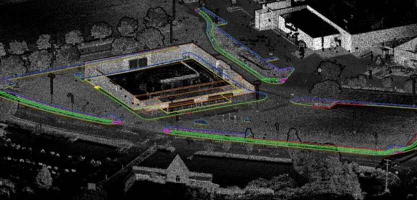
The program follows the data past the field. Speakers will show how captured data becomes linework, drawings and surface information for applications such as roadway drainage and ponding analysis. Attendees will also learn how to select the appropriate capture method, process and validate the data, and move from field collection to actionable project information.
Speakers
David Bonney, Director, Channel Sales at FARO Technologies, holds a degree in geographic information systems from the University of Maryland and has two decades of experience bringing geospatial and reality capture technologies to market through global distribution networks. Since 2019, he has led U.S. distribution initiatives for GeoSLAM and FARO in the architecture, engineering, construction and operations sector.
Nathan West, Senior Account Manager at Point3D Inc., works with construction, engineering, architecture, environmental, forestry and government teams on laser scanning, mobile SLAM and UAV LiDAR projects. Point3D is a FARO authorized reality capture provider serving the Mid-Atlantic and Northeast. West’s recent field work includes mobile scanning aboard the SS United States ahead of its conversion to an artificial reef, where the Point3D team developed a body-mounted lighting rig to capture the ship’s pitch-black lower decks with the FARO Orbis. The Orbis is a hybrid scanner that combines mobile and stationary scanning in one device. West has presented on the Orbis at the ACEC Metropolitan Washington Annual Conference and spoke at the Applications & Solutions in Digital Forestry International Conference at Purdue University.
Avi Deutsch, Owner and CEO of AVID Imaging, leads a company that provides precision laser scanning, scan-to-BIM and as-built documentation services.
How to Attend
The webinar is scheduled for Wednesday, November 4, at 1:00 p.m. ET. Registrants who cannot attend live will receive an invitation to view the session on demand. Register now HERE.