
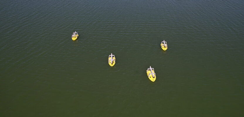
Hydrographic survey has always demanded precision, expertise and significant resources. Now, it’s also becoming fast, accessible and scalable.
By Vicki Speed
The hardest part of hydrographic survey in modern practice is typically not the physics. Multibeam sonars, inertial navigation and sound-velocity profiling have been able to map the seafloor in exceptional detail for years.
The real friction has been everything around those solutions from mobilizing a crewed vessel and working tight weather windows to repeating lines with precision to trust change detection while doing it all without blowing the budget.
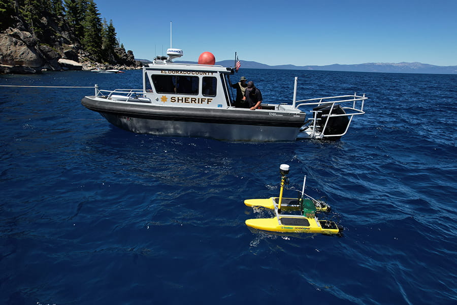
Unmanned surface vehicles (USVs) are changing that calculus. By pairing high-resolution sensor suites with autonomous navigation and shore-based control, today’s unmanned hydrographic systems deliver survey-grade data faster, more safely and, on many projects, more economically than traditional crewed operations.
Case in point is Sacramento-based Seafloor Systems, founded by John Tamplin in 1999, when the market for unmanned hydrographic platforms was limited, the sensors were still large and the navigation systems fragmented. He started with a single plastic catamaran. Today, Seafloor designs and manufactures a range of seven different USV models that are active on projects from Pearl Harbor to the New York Harbor.
Many of these applications have moved from single-platform surveys to coordinated multi-vehicle operations, in which unmanned fleets map simultaneously, adapt coverage in real-time and stream processed data to decision-makers on shore, are no longer theoretical.
The multi-vehicle coordination capability that Seafloor has advanced, what they call “Mother Duck” mode, is emerging as one of the clearest early expressions of where the industry is headed next. At the Esri User Conference in San Diego this past July, Seafloor joined a team of industry partners to demonstrate exactly that: a simulated post-storm port assessment, multiple unmanned platforms operating in coordinated formation, bathymetric data flowing in real time from the water through hydrographic processing software to GIS analysts on shore.
The USV Deep Dive
The USV market has grown considerably since early platforms first appeared in hydrographic applications in the 2000s. The early purpose-built research tools were often expensive, operator-intensive and prone to instabilities. Today, it’s a tiered commercial market with platforms designed for specific operational niches that include shallow-water dredging, offshore inspection, confined bridge substructure work, harbor surveys, etc.
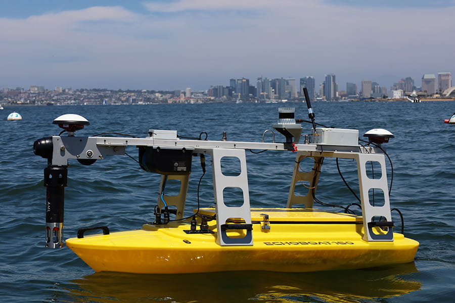
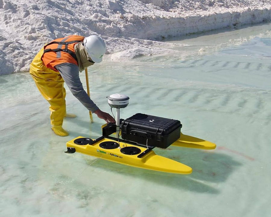
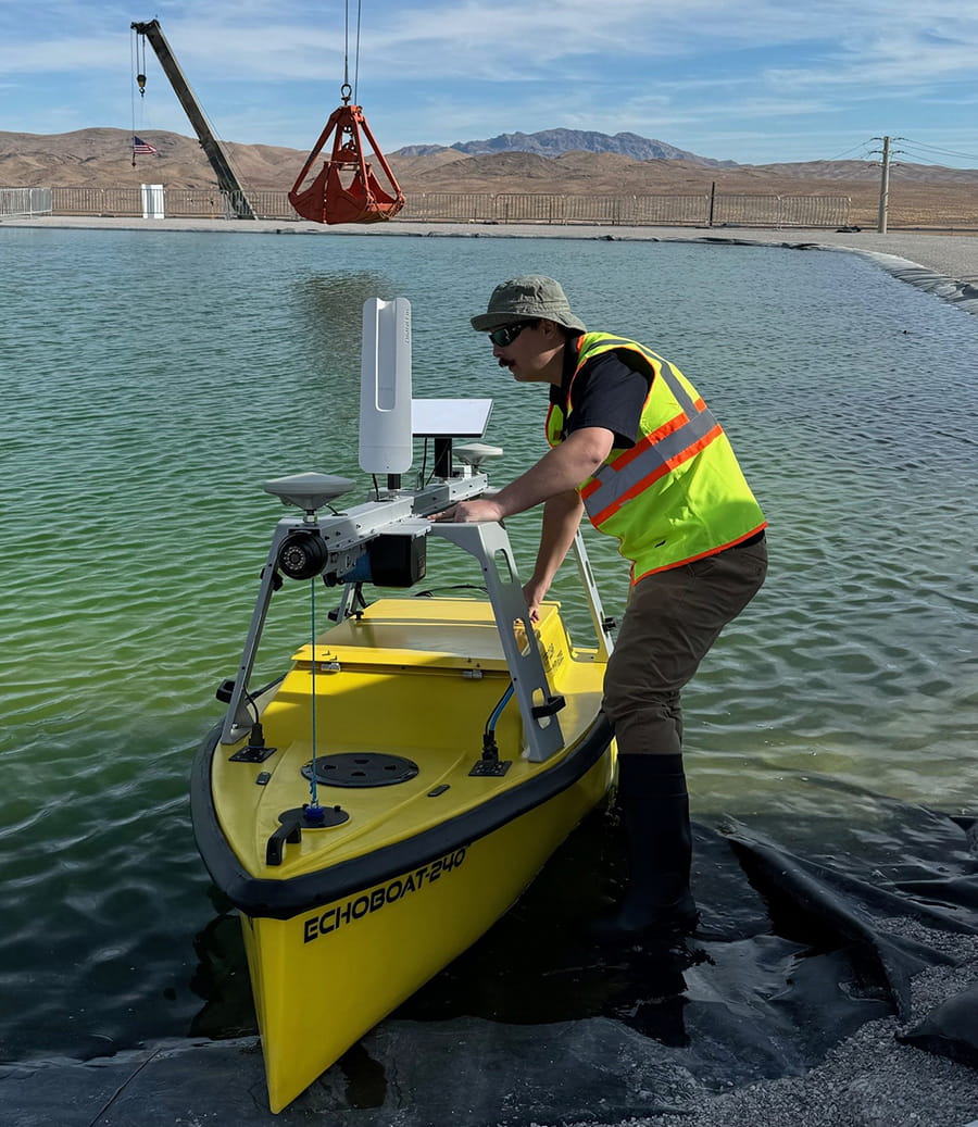
Seafloor’s current lineup reflects that maturation with a fleet that spans seven platforms from 1.2 meters to 6.7 meters in length, each designed for a different operational environment and payload requirement. They operate in inshore, protected waterways up to offshore operations up to sea state 5 on the Beaufort scale. Among the solutions is the EchoBoat-160, a 1.6-meter monohull that fits in the back of a pickup truck, can be hand-carried to the water’s edge and is operational within 30 minutes of arriving on site. At the other end of the range, larger platforms carry heavier sensor payloads for offshore endurance work.
All platforms share a design philosophy centered on operational ease in the field. A single button powers the entire system. One operator handles deployment, data acquisition, calibration and post-processing. Long-range Wi-Fi (2-kilometer line of sight) connects the vessel’s onboard PC to a shore-based laptop via remote desktop; a 4G hotspot option removes the line-of-sight restriction entirely in areas with cellular coverage.
“Anyone can build a boat,” Tamplin says. “The challenge is integrating the sensors into a platform, or multiple platforms, and having it operate flawlessly, producing the results that customers need, time after time, project after project.”
A modern Seafloor Systems USV is a carefully assembled stack of sensors, each selected for accuracy and field reliability, and increasingly for how tightly they integrate with each other. Several projects show what that looks like when the stakes are highest.
Visualizing Underwater Risk
At Pearl Harbor, Seafloor supplied an EchoBoat-240 equipped with a Teledyne RESON T50 multibeam echosounder to a joint venture of Flatiron-Dragados, Hawaiian Dredging and Orion Government Services, monitoring construction progress on the new submarine dry dock. As the site is dredged to make room for the new underwater structure, the platform surveys both the excavation progress and the surrounding seafloor, giving the joint venture continuous, current data on a project.
The Ohio Department of Transportation (ODOT) bridge inspection project shows the other end of that spectrum: a single high-resolution pass revealing decades of hidden structural risk.
The Route 127 bridge over the Great Miami River in Hamilton, Ohio had not had a true hydrographic survey of any kind conducted around it in decades, if ever. Engineers working on it had nothing more current to go on than old drawings and as-built records, with elevation data that hadn’t been updated in years.
The location also ruled out a traditional crewed survey vessel. More conventional inspection approaches wouldn’t have solved the problem either. Mechanical scanning sonar and single-beam echosounders don’t resolve fine structural detail, and sending divers down to check by hand meant putting people into hazardous, low-visibility water.
Working with ODOT and The Ohio State University, Seafloor deployed an EchoBoat-160 carrying a SeaRAY multibeam sonar, paired with a Trimble-Applanix inertial navigation system and AML sound-velocity sensors, the same combination that lets the platform hold its position even through momentary GPS loss beneath the bridge deck. The crew had it launched from the riverbank and collecting data within about 30 minutes.
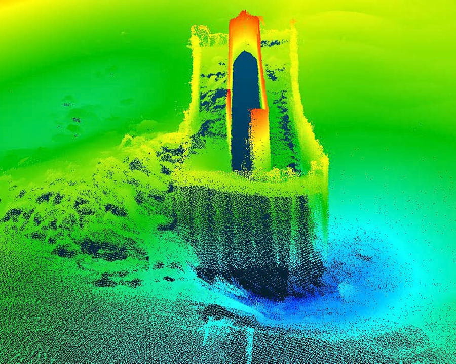
In just 34 minutes of active scanning, the system logged over 17.5 million soundings at depths from 2 to 30 feet, capturing complete point-cloud coverage of the bridge piers, including the zone where scour erodes the pile foundations holding the structure up.
The inspection found a scour hole roughly 2 feet deep at the pier face, plunging to nearly 30 feet at its center. The scan also picked up sediment buildup and debris trapped behind the sheet-pile wall, along with several trees, previously cleared from the piers, that had drifted downstream. Where older single-beam surveys had only hinted at a scour hole’s presence, the multibeam-derived TIN model and contour lines pinned down its precise shape, depth and how far it had encroached on the structure itself.
Hawaii and Ohio showed what a single platform is capable of. The next step was to demonstrate the potential of multiple platforms.
The Swarm Effect
On the Hampton Roads Bridge-Tunnel (HRBT) expansion in Virginia, one of the largest active infrastructure projects in the country, three Seafloor platforms, a HydroCat-550, an EchoBoat-240 and an EchoBoat-160, are working simultaneously, each outfitted with its own multibeam system. Rather than a single vessel handling the entire survey footprint, the fleet splits the work across platforms suited to different parts of the job. It’s an early, smaller-scale version of the coordination logic that Mother Duck mode later formalizes.
The next step was to formalize that coordination: many platforms surveying one area at the same time, directed as a single operation rather than several independent jobs—in essence, the Mother Duck mode.
The Mother Duck mode may represent the most meaningful step forward in hydrographic survey efficiency since the USV itself. The concept was developed in collaboration with Xylem’s HYPACK software team, which built the coordination layer; the name comes from HYPACK.
The premise is that a central “Mother” vessel, manned or unmanned, deploys multiple USV platforms to a survey area. The smaller platforms, directed by an operator at the mother vessel’s base station, fan out in coordinated formation (a V formation, like a flock of geese) and begin covering their assigned areas simultaneously.
Each platform surveys its designated zone while continuously communicating over a mesh network, streaming sensor data in real time to the HYPACK base station. HYPACK displays all USV positions and survey progress on a unified situational-awareness screen, pre-processes incoming multibeam, LiDAR and side scan data in real time, and coordinates coverage so that each platform’s survey lines adapt dynamically based on what adjacent platforms have already collected. There are no gaps, and there is no overlap wasted.
“They’re adapting to each other,” Tamplin explains. “The coverage adapts based on the coverage of the previous one.” While the Mother Duck scenario is not fully autonomous in the sense of making independent mission decisions, the boats navigate and execute their survey lines without manual input per-action. Mission direction such as where to deploy, what areas to cover and how to respond to changing conditions comes from an operator at the mother vessel’s base station. The operator manages the flock; the flock handles the flying.
The concept has moved from demonstration to production very quickly. Seafloor is currently building two four-meter platforms, carrying dual outboard motors, for the U.S. Army Corps of Engineers New York District. The platforms will work in conjunction with the Corps’ 65-foot manned survey vessel to survey and map New York Harbor, its channel and surrounding inlets as the Corps dredges and deepens the channel and anchorage to accommodate larger-draft vessels. In swarm mode, up to ten unmanned platforms working together will let the team map the area quickly and efficiently.
Fixed parallel survey lines with manually calculated overlap produce uneven coverage and wasted time. Multi-platform dynamic line planning eliminates both, and New York Harbor will be the largest test yet of that efficiency gain at production scale.
Ports in a Storm
The most public demonstration of the Mother Duck capability took place in July at the Esri User Conference in San Diego. The exercise, called the Rapid Assessment Survey System (RASS), war-gamed the aftermath of a major storm striking the Port of San Diego: shifted channel depths, aids to navigation knocked out of position, berths and cruise terminals no longer at their charted depths, debris scattered through the channel, and port officials needing to figure out fast what dredging would now be required.
The demonstration partners were Seafloor, HYPACK (Xylem), Esri and the Port of San Diego. Each had a defined role in a workflow designed to show that coordinated USV survey is possible and that the data it generates can flow all the way through to actionable decision support in the hands of port operators and emergency responders.
In this case, three Seafloor EchoBoat-160 platforms, each equipped with multibeam echosounder, LiDAR, and optional side scan sonar, deployed within minutes from a single base station and began surveying the port’s critical areas simultaneously using Seafloor’s Mother Duck multi-vehicle capability, keeping all survey personnel out of the water and away from post-storm hazards while coverage proceeded at a pace no single crewed vessel could match.
HYPACK’s software provided real-time coordination during the survey, displaying all USV positions and progress on a unified situational-awareness screen and pre-processing incoming multibeam, LiDAR and side scan data as it was collected. From there, the data was processed, converting the results into Bathymetric Attributed Grid (BAG) files carrying the bathymetry itself along with metadata and uncertainty values. Esri then took those files into its Bathymetric Information System (BIS), where the new readings were checked against pre-storm records and existing electronic navigational charts (ENCs).
The system built updated S-102 surfaces and chart cells from the comparison, flagged what had changed since the storm and turned all of it into working charts for the teams responsible for restoring aids to navigation, for harbor pilots, and for other port staff. Throughout, HYPACK LINK, a cloud-based SaaS platform powered by Esri, gave remote decision-makers real-time visibility into USV positions, survey progress, and incoming data as the exercise unfolded.
The scenario has clear real-world application: post-hurricane port assessment, flood-driven bridge scour surveys, maritime incident response or any situation where a port, waterway or coastal infrastructure manager needs to rapidly understand what has changed underwater and communicate that picture to decision-makers. The RASS demo was designed to show that the entire pipeline, from USV deployment to GIS-ready bathymetric products, can be executed by a coordinated team in a compressed timeframe.
“It’s not just the acquisition,” Tamplin explains. “It’s how the data flows in real time back to the responders, to the port, to the folks who are going to have to handle the response.”
Coordination, Coverage and Continuity
All of Seafloor’s current platforms are at Technology Readiness Level 9, with work continuing to extend the envelope of what coordinated automated survey can do.
The practical roadmap involves fusing additional sensor modalities into each platform’s situational awareness layer: stereo cameras for visual obstacle detection, LiDAR for range-based avoidance, radar for all-weather surface awareness and Automatic Identification System (AIS) for vessel traffic awareness. The goal is platforms that react to traffic, obstacles, environmental conditions and the geometry of the survey already completed, closing gaps in coverage automatically, adjusting to conditions without operator intervention at the individual vehicle level.
“We’re fusing all that data, all these sensors, and enabling the platforms to be more and more automated,” Tamplin says. “To react to traffic, react to obstacles, react to the environment and react to the survey line before it so there’s no gaps in coverage.”
Tamplin reaches for a familiar comparison to describe where this is headed. “We want to get to that level three or level four autonomy mode, like Tesla,” he says. The comparison is apt in one specific way: the goal isn’t removing the operator, but reducing the moment-to-moment demands on them to the point where a single person can confidently oversee a multi-platform operation across a large area, intervening only when conditions require it.
For Seafloor, 26 years in, the pace of change in the field shows no sign of slowing. The sensors keep improving. The platforms keep accumulating operational hours. And the production contracts, such as Pearl Harbor, Hampton Roads and New York Harbor, keep moving from impressive references to industry benchmarks.
The flock is getting bigger. And it’s learning to fly in tighter formation.