

By Dr. Mark Bynoe and Sven Cowan
When a major storm sweeps across the Caribbean, coastlines can change in an instant. Beaches vanish. Cliffs shear away. Floodwaters push inland into neighborhoods and tourist meccas once considered safe.
Climate change poses significant problems in the region. Damaging floods and storms have more than tripled since the early 2000s, resulting in countries suffering yearly losses equal to 17% of their GDP. This is seen as perpetual recession as the region grapples with this constant threat.
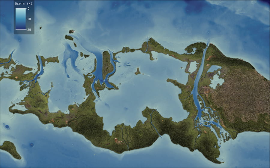
For years, governments across the region have worked to plan for these accelerating impacts, often financed from loans and concessional financing. But they were often missing one essential ingredient: precise, high-resolution data showing how their landscapes were shifting beneath warming temperatures, rising seas and stronger storms.
That gap is now closing. Through a groundbreaking regional initiative led by the Caribbean Community Climate Change Centre (CCCCC), more than a dozen island nations are gaining access to detailed topographic, bathymetric and coastal elevation data, information that has previously been out of reach for most Caribbean economies. As part of a multiyear partnership, CCCCC is working with NV5 Geospatial to regularly deliver imagery and topographic and topobathymetric light detection and ranging (lidar) at 1 meter resolution, creating the region’s first consistent, comparable baseline for climate adaptation.
A Coordinated Effort for Collective Resilience
The Caribbean’s climate challenge is uniquely complex. Small land areas, densely populated coastlines and increasing exposure to Category 4 and 5 storms exposes them to severe vulnerability. Yet most Caribbean nations lack the resources to conduct comprehensive lidar surveys on their own. The CCCCC initiative, which began as a funding effort in 2018 with survey flights launching in 2022, changed the equation by coordinating annual, regionwide surveys that pool costs, standardize methods and ensure every participating country receives data, largely, of the same technical quality.
The scale of the effort is unprecedented. In 2023, the team completed 1,857 square kilometers of surveys across six countries, in a project financed by the Caribbean Development Bank. With support from Global Affairs Canada (GAC) and the United States Agency for International Development (USAID), the program saw a 20% increase in coverage, expanding to 2,330 square kilometers across nine countries in 2024, and last year, the campaign covered another 1,118 square kilometers across four countries.
The program’s aircraft is equipped with advanced lidar sensors – a CCCCC-owned topobathymetric lidar system and NV5 Geospatial’s system that integrates topographic lidar with a high-resolution true color camera. Combined, these sensors capture both land elevation and shallow seafloor depth at densities of 4-6 points per square meter (ppsm). Once the data is collected, NV5 Geospatial processes all topobathymetric lidar, topographic lidar and imagery datasets, giving governments a complete, integrated view of their geography.
For many countries, the regional model has dramatically reduced costs. Before the CCCCC program, lidar flights were rare and expensive, often requiring individual governments to contract companies from North America. Through collaboration with CCCCC, regular data collections are more economical, resulting in a valuable, recurring tool rather than a onceinadecade luxury.
From Rough Estimates to Reality
For climatevulnerable nations, the difference between the 30meter satellite data they had relied on and the 1meter lidar now available is the difference between guessing and knowing. Lidar penetrates vegetation to reveal true ground elevation and maps shallow waters to show how coastlines are changing, producing detailed digital elevation models (DEMs).
This granularity is critical for understanding storm surge, evacuation and disaster planning, infrastructure design and coastal erosion monitoring. It also provides a foundation for environmental management, landuse planning and natural resource protection that is improving the lives of people across the Caribbean.
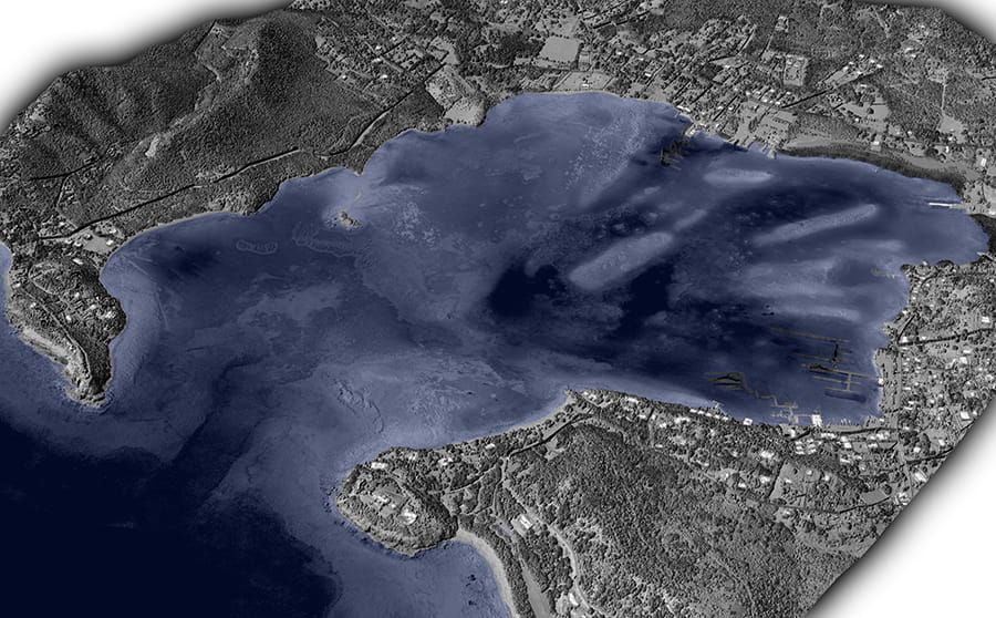
View of Falmouth Harbour, Antigua. Topobathymetric surface model colored by intensity – bathymetric coverage highlighted in blue. Image by Chris Miwa.
Where Regional Data Becomes Local Power
Across the Caribbean, governments are beginning to translate the new lidar datasets into realworld climate decisions. This progress is possible because the CCCCC is not just delivering data, it is building the expertise required to use it.
Through regional training and knowledge sharing, teams in Caribbean countries are learning how to process point clouds, run coastalchange analyses and integrate lidar into their own environmental databases. A datasharing portal gives agencies direct access to source datasets and supports the use of lowcost, opensource tools. And new analysis workflows – from featureextraction models to naturallanguage geospatial interfaces – make it easier for small teams to move quickly from questions to answers. Together, these investments ensure that the lidar program becomes a longterm capability, not a onetime delivery.
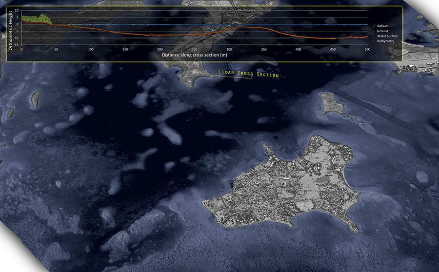
View of Long Island, Antigua. Topobathymetric surface model colored by intensity – bathymetric coverage highlighted in blue. A cross section (in yellow) demonstrates topobathymetric lidar coverage and depth from the shoreline. Image by Chris Miwa.
RealWorld Impact from Antigua to Barbados
In Antigua and Barbuda, lidar is helping the Department of Environment replace a patchwork of global datasets and fragmented local surveys that often conflicted with one another. Analysts there have long had to stitch together information from satellite imagery, field surveys and older elevation models – an approach that created inconsistencies and data gaps, while also resulting in duplicated and manual efforts.
Through the CCCCC program, they now have a unified, accurate foundation for planning. The data is being integrated into the country’s environmental database to support vegetation mapping, watershed and drainage analysis, coastal feature identification, and the development of updated national elevation and surface models. For the first time, the country can build geospatial layers that reflect the landscape as it actually exists, rather than approximate global models.
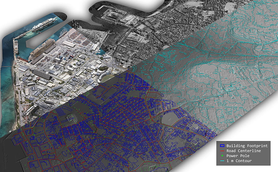
Across Barbados, the initial 2023 campaign was comprised of more than just basic elevation and coastline mapping data. It included a more detailed analysis, including vegetation and building heights; road center lines and bridges; utility poles; coastal watercourses, culverts and drain center lines; and classification of land uses and coastal resources – all of which now feed directly into coastalzone management, infrastructure planning, and environmental monitoring.
Barbados shows how quickly that capacity can translate into action. With two lidar surveys flown just two years apart, coastal managers were able to compare bathymetry and confirm that stormdriven sand shifts had not buried vulnerable coral reefs. Subtle changes in sediment distribution revealed how beaches recover after major storms, while repeat elevation data helped officials identify cliff failures along the remote East Coast, which often go unnoticed until someone happens upon them.
A Data Strategy with Far-Reaching Impact
Beyond climate adaptation, the lidar data also benefits other agencies in the countries, including those managing transportation, infrastructure and land surveys. This multiplier effect is one of the initiative’s most powerful outcomes: a single coordinated data effort serving dozens of government applications.
As climate impacts accelerate, the CCCCC model offers a replicable blueprint for other vulnerable regions: Pool resources, standardize data, build regional capacity, and ensure that every nation – regardless of size or budget – has access to the information it needs to protect its people and conserve its environment.
The CCCCC model shows what coordinated investment can unlock: consistent detailed data, shared expertise and a longterm system for understanding change as it happens. It’s a blueprint other climatevulnerable regions can follow and a turning point for Caribbean nations preparing for the decades ahead.
About the Author
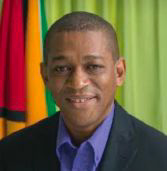 Dr. Mark Bynoe is Director, Business Strategy and Regional Coordination, OED for the Caribbean Community Climate Change Centre (CCCCC). He is a Senior Resource Economist at CCCCC and has over 25 years working in the environmental and climate change fields. He holds a PhD in Economics from East Anglia, an MSc in Resource Management from Edinburgh University and a BSc in Geography/Economics from the University of Guyana. Mark has an interest in climate and development financing, risk management and vulnerability and impact assessments. He works with partner institutions to build development resilience to climate variability and change. He has over 30 publications in reputable journals and books.The CCCCC is an intergovernmental organization established by the Heads of Governments of the Caribbean Community (CARICOM) to coordinate the region’s response to managing and adapting to climate change. The CCCCC also serves as a delivery partner for climate finance for the region, a repository for regional climate change information and data provider of climate change-related policy advice and guidelines to the CARICOM Member States.
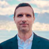 Sven Cowan is a program manager at NV5 Geospatial. Sven has served as the operational lead providing oversight for all components of the CCCCC survey program and the associated annual acquisition campaigns.