
All posts by Jeff Salmon
UAS: From FUD to FOMO
By Jeff Salmon Welcome to our semi-annual UAS-focused issue. Looking back over the last six years of UAS development, I am struck by how far the technology has progressed. Right before our eyes a new industry has developed, one that promises to bring far-reaching changes to our profession and indeed to the whole world. And...

Back to the Moon? Or—Straight on to Mars?
Editor’s note: at xyHt and Pangaea we’ve been adding “geo-space-al” content into our geospatial mix, and readers have been responding positively. Surveying on Mars is a great example. When you think about it, geospatial technology and space are inextricably intertwined; from GNSS to satellite-based remote sensing, we rely on space-based technology to tackle almost every...

15 Years of Growth at AXIS GeoSpatial
AXIS GeoSpatial provides more applications from one mapping effort. Easton, Maryland-based AXIS GeoSpatial LLC provides geospatial data and solutions to federal, state, and local government agencies and private sector firms, especially aerial mapping services. Heights talked with Erica Insley, marketing director for the firm. Heights: How did AXIS GeoSpatial get its start? Erica Insley: Founded in...

UAS Regulations Update
A look at recent and near-future legislation affecting UAVs for geospatial business use. By Jeff Salmon BVLOS Update The ability to fly beyond line of sight (BVLOS) is paramount to a wide range of UAS operations, including utility and pipeline inspections and monitoring, open pit mining, precision agriculture, corridor mapping, large-area mapping and surveying, and...
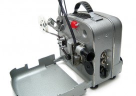
Geospatial on the Big (and Little) Screen
I get excited anytime I see the tools and technology of the geospatial profession in the media. Positive media exposure to the general public of all things geospatial can be a powerful tool to help build awareness for the profession. Additionally, it helps “build the brand” for the next generation, getting them interested in the...
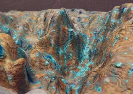
Back to Dinosaur Ridge
Close-range 3D photogrammetry solves mystery of 100-million-year-old dinosaur tracks. Back in the summer of 2014, I visited Dinosaur Ridge, just west of Denver, Colorado, as part of a demonstration of close-range photogrammetry given by CAE Mining, which uses the technology in its volumetric mine site analysis software. Dinosaur Ridge has become one of the world’s...