All posts by Jeff Salmon
The Next Generation of UAVs
The future of unmanned aerial vehicles for the geospatial profession looks to include bigger platforms for better sensors. A Drone by Any Other Name The question came up recently: “What’s the difference between a drone and a UAV?” The short answer is: none, the terms are synonymous. Which opens up a big can of alphabet...

The New Spacescape
Small satellites are changing who dominates the field of satellite remote sensing. Move over military and government policy and regulation. Make way for private companies and even the public. There are big changes afoot in the satellite remote-sensing field: improved technology as well as regulatory shifts enabling the application of this technology (see “New Markets for Satellite...

State of: UAS
Multiple names and acronyms are used for this technology: UAS, UAV, and the sadly ubiquitous “drone.” The mapping industry avoids the military connotation of “drone” and prefers UAS (unmanned aerial system) to UAV (unmanned aerial vehicle). UAS encompasses the entire system: the unmanned aircraft and sensor package, the ground control system, the control link, a...

State of: Close-Range Photogrammetry
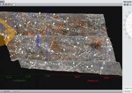
By definition, close-range photogrammetry (CRP) is simply photogrammetric data collection and processing where the subject is less than 1,000 feet away. Collection methods can be both ground- or aerial-based, and the final output can be rendered either two- or three-dimensionally. Several factors have made this a powerful tool for geospatial professionals. The strongest of these...