All posts by Jeff Salmon

Shark Week at Pangaea
With Discovery Channel’s “Shark Week” taking a big bite (sorry couldn’t help it!) out of my 4th of July weekend, my thoughts naturally turned to unmanned systems. Well, actually, thoughts on how unmanned systems are being used to study sharks with an eye to protecting both them and humans. Let’s start with that last application,...

Part 107 Goes Live: UAS Unchained (Mostly)
The FAA said that it would have its Small Unmanned Aircraft Regulations ready by this summer, and by the second day of summer, it did. Rule 107 takes effect in late August and applies to unmanned aircraft (UAS) weighing less than 55 pounds that are conducting commercial operations. Let’s take a quick look at the...

Spatial Networking for Fun and Profit
Recently I attended a UAV event in my area (watch for the July issue of xyHt for more) that got me thinking about the role of networking in our profession. Not RTK, CORS, or even WANs or LANs, but person-to-person networking. Networking for fun. Meeting new people in the geospatial profession (and especially those interested...

senseFly’s Andrea Halter: From Academia to the Market
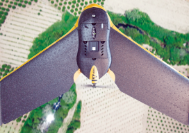
Above: This eBee Ag is outfitted with the Sequoia multispectral sensor. An interview with senseFly’s Andrea Halter Andrea Halter is a co-founder of senseFly, a Parrot company based in Switzerland that develops and produces aerial imaging drones for professional applications. Halter oversees the company’s marketing and sales teams. She’s a qualified land surveyor and holds a...

Primed for Growth
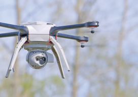
Aeryon epitomizes the current and coming uprising in UAS. The global UAS market (according to MarketsandMarkets) is set to grow at a 34.36% compound annual growth rate from 2015 to 2020, with UAS shipments to reach 3.8 million units in 2020. A new report from the FAA backs up this forecast, with a somewhat lower...

UAS: It’s Unstoppable and Headed Your Way
From time to time I like to stop and think about the mission of Pangaea and explain that mission to you. My task is exposing you to new, emerging geospatial technologies. But why bother? Here’s a little analogy I thought of to help explain why keeping abreast of new geospatial tech is critical. Imagine emerging...
