All posts by Rudy Stricklan
Web Waypoints: Databased Mapping
An interactive exercise merging the topo-graphical and the topo-logical Editor’s note: Just about any interaction we have with the digital world is enabled through the power of database technology: our smartphone apps, the web, shopping, work, and play. A lot of this is behind the scenes and taken for granted. Data-collection software for surveying is becoming increasingly...
Web Waypoints: Maps as Database Reports
An interactive exercise merging the topo-graphical and the topo-logical.At the conclusion of the first article in this series (April 2013, “Databased Mapping”), I provided a web link for readers to respond to a brief list of questions about software they’ve used for surveying-related mapping purposes. Surprisingly, there were a statistically significant number of responses. Well,...
Esri Developer Summit 2015 Highlights
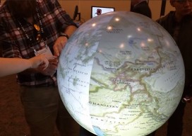
The 2015 Esri Developer Summit (colloquially referred to as the “DevSummit”) was held in Palm Springs, CA, March 10-13. Two thousand+ programmers and technologists participated, seeing the latest developments for building applications in ArcGIS web, desktop and native coding environments. I particularly enjoy the DevSummit events, since they are entirely geekfest in nature, as opposed...
Feature: Surveying Google
Three days submerged in the Googleplex through a surveyor’s eyes.One of my side gigs is as an adjunct lecturer on GIS with the University of Arizona. Through that association, I was recently given the opportunity to attend the first Google Geo for Higher Ed workshop at Google’s corporate headquarters in Mountain View, California. Referred to as the “Googleplex,”...
FieldNotes: Arizona PLS Assoc. Conference Addresses GIS and Surveying Standards
The Arizona Professional Land Surveyors’ Association held its annual state conference April 24-26 at the Prescott Resort in Prescott, Arizona. Attended by more than 200 surveyors and geospatial professionals, the conference featured national speaker Jeff Lucas on boundary disputes and pincushion problems, Warren Ward on the location of the Four Corners monument, and Michael Dennis...
GIS
PSM APRIL 2013 PSM’s April issue begins the series Databased Mapping, about building the ultimate surveying database that not only stores surveying project data but also structures it to be able to produce accurate reports, analyses, and visualizations that do not depend on the way the data itself is stored.The Web of Things The theme of our...