
Blog
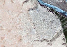
Antiquities Trafficking and the Surveyor: How Mapping is Keeping History Public
Conflicts around the world are often funded by the sale of drugs, guns, diamonds, ivory, and antiquities. Often these cultural relics stolen from home countries are purchased unwittingly abroad. One organization is hard at work to alert buyers and the art market about this growing problem, using maps to broadcast the stories of missing artifacts....

xyHt Magazine! Digital Edition for July 2020
xyHt is here again! If you don’t have a subscription to our print editions, or if someone else in the office has snaffled your copy, never fear—here’s the digital edition. Click here, or on the cover to the right, to view the July 2020 issue of xyHt magazine. Articles in the issue include: (Links will...

Plan Ahead: GeoIgnite (Virtual), July 2020
The inaugural GeoIgnite in 2019 was great success, and we are happy to help announce that GeoIgnite 2020 will be held as a virtual event, July 22nd-24th, 2020. This new series of geospatial events is an opportunity for geomatics and geospatial professionals and practitioners to expand their horizons, showcase their geo-wares and services, hear from...
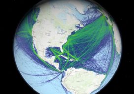
Global Shipping Needs Geospatial Technology
Response to Covid-19 and its ripple effects on trade may be accelerating maritime industries’ adoption of geospatial technology Where global shipping is concerned, the Covid-19 pandemic is changing everything from navigation pathways, to crew and ship safety, to demand for commodities, and forcing the shipping industry to adapt, in part through new uses of geospatial...

xyHt Weekly News Links: 06/26/2020
*Click here to visit xyHt’s Virtual Trade Show* SBG Systems has New Miniature Sensors for Navigation Microdrones Invites You to Play the Ultimate Surveying Game Show: SURVEYOR SAYS. Mobile Laser Scanning Technology Workshop Postponed ConTech Roadshows Rescheduled Monitoring and Protecting Ecosystems from Space China Launches Final Beidou Satellite; Completes GPS-like Nav System Ground Penetrating Radar...

Reference Framework Update Delayed
Roll out of the National Spatial Reference System (U.S.) update, originally envisioned for 2022, may not complete until a 2024-2025 time frame. Many reasons are contributing to this delay. FAQ from the National Geodetic Survey: bit.ly/2Z09z6L
Advertisement